|
search place name
|
||
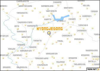
Hyŏngje-dong (Hwanghae, Korea, North)Hyŏngje-dong is a town in the Hwanghae region of Korea, North. An overview map of the region around Hyŏngje-dong is displayed below.
regional and 3d topo map of Hyŏngje-dong, Korea, North ::
Hyŏngje-dong airports ::
The nearest airport is FNJ - Pyongyang Intl, located 108.5 km north west of Hyŏngje-dong.
Other airports nearby include GMP - Seoul Gimpo (114.2 km south), SSN - Seoul East Seoul Ab (133.2 km south), OSN - Osan Ab (169.1 km south), SHO - Sokch'o Sokcho (180.6 km east), Nearby towns ::
Chŏngbong-ni (0.3km south east) //
Kodo-dong (1.9km north east) //
Maktae-ri (2.4km north west) //
Haam-dong (3.1km south) //
Sirubau (3.2km south east) //
T'aebong-dong (3.7km south west) //
Chunun-dong (3.7km north west) //
Kwant'ŏ (5.0km north) //
Masal-li (5.0km south) //
T'ŏ-gol (4.5km south east) //
Yŏulmegi (5.0km north) //
Tarakt'ŏ (4.7km south west) //
Sin'gong-ni (5.9km north) //
T'aeŭl-li (5.7km north east) //
Mayu-dong (5.3km north east) //
Ch'ŏn'gae-ri (5.3km east) //
Hwasŏng-ni (5.6km north west) //
Sep'i-dong (5.7km east) //
Sŏ-dong (7.5km north) //
Padap'ogae (7.3km north) //
Yuch'ŏn-dong (7.2km south west) //
Mŏkpang-dong (6.3km east) //
Wangdang-ni (8.0km south) //
Sanyang-ni (8.1km north) //
Pujo-dong (7.2km north east) //
Su-dong (7.4km south west) //
Sech'a-dong (6.9km north east) //
Sanyangam (8.4km north) //
Saemal (8.5km south) //
[all distances 'as the bird flies' and approximate]  Places with similar names to Hyŏngje-dong, Korea, North ::
// Hyŏngje-dong (KP)
// Yangja-dong (KP)
// Yangjae-dong (KP)
// Yangji-dong (KP)
// Yangji-dong (KP)
// Yangji-dong (KP)
// Yangji-dong (KP)
// Yangji-dong (KP)
// Yangji-dong (KP)
// Yangji-dong (KP)
Disclaimer :: Information on this page comes without warranty of any kind |
||
|
Where is Hyŏngje-dong? Elevation and coordinates ::
Latitude (lat): 38°34'38"N Longitude (lon): 126°36'28"E
Elevation (approx.): 204m (map arrows pan, magnifying glasses zoom) |
||
|
Visiting Hyŏngje-dong? Hotel/Accommodation ::
Book a hotel in Hyŏngje-dong Travel Guide ::
rental cars ::
car rental offers GPS waypoint ::
download a GPX waypoint (PoI) of Hyŏngje-dong for your GPS receiver
|
||