|
search place name
|
||
Kamaŭngdŏngi (Hamgyŏng, Korea, North)Kamaŭngdŏngi is a town in the Hamgyŏng region of Korea, North. An overview map of the region around Kamaŭngdŏngi is displayed below.
regional and 3d topo map of Kamaŭngdŏngi, Korea, North ::

Nearby towns ::
Haejup'yŏng (0.8km south) //
Kapsan-gol (2.2km south west) //
Chu-dong (2.9km south west) //
Kan'gapsan-dong (4.5km south west) //
Chang-dong (4.6km south west) //
Tae-dong (5.4km south east) //
Sohwayang-dong (5.1km west) //
Yujŏng (6.2km south west) //
Ch'ŏndogi-gol (6.2km north east) //
Tonggol-gol (6.3km east) //
Taesŏgok (8.1km south) //
Chung-mal (7.4km south west) //
P'ungmudŏgi (8.1km south west) //
Araegapsan-gol (8.6km south west) //
Kwan-dong (8.7km south east) //
Sŏng-dong (8.8km south west) //
T'op'odongŏgu (9.9km north east) //
Sŏngdŏk (10.8km north east) //
Ch'unhŭng-ni (10.7km north east) //
[all distances 'as the bird flies' and approximate] 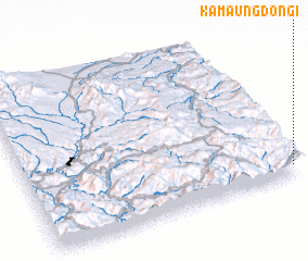 Places with similar names to Kamaŭngdŏngi, Korea, North ::
// Kamenica Donja (BA)
Disclaimer :: Information on this page comes without warranty of any kind |
||
|
Where is Kamaŭngdŏngi? Elevation and coordinates ::
Latitude (lat): 41°3'58"N Longitude (lon): 128°59'24"E
Elevation (approx.): 1320m (map arrows pan, magnifying glasses zoom) |
||
|
Visiting Kamaŭngdŏngi? Hotel/Accommodation ::
Book a hotel in Kamaŭngdŏngi Travel Guide ::
rental cars ::
car rental offers GPS waypoint ::
download a GPX waypoint (PoI) of Kamaŭngdŏngi for your GPS receiver
|
||