|
search place name
|
||
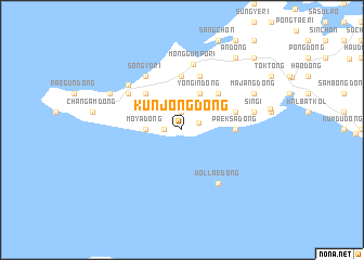
Kunjong-dong (Korea, North)Kunjong-dong is a town in Korea, North. An overview map of the region around Kunjong-dong is displayed below.
regional and 3d topo map of Kunjong-dong, Korea, North ::
Kunjong-dong airports ::
The nearest airport is FNJ - Pyongyang Intl, located 146.7 km north east of Kunjong-dong.
Nearby towns ::
Kyeŭm-dong (1.5km west) //
Paeksŏk-tong (1.9km north) //
Och'ajil-li (1.6km north east) //
Moya-dong (2.9km west) //
Yongin-dong (4.0km north) //
Mup'a-dong (4.7km north west) //
Ch'ukhyŏn (4.7km north east) //
Monggŭmp'o-ri (5.6km north) //
Tarinae (5.6km north) //
Taejŏng-dong (5.6km north) //
Paeksa-dong (4.4km east) //
Noha (5.7km north) //
Choni-dong (5.7km north) //
Majin (4.8km north east) //
Ch'ŏngdol-tong (5.7km north west) //
Sŏn'gyo-ri (6.3km north west) //
Sŏnwŏn-dong (6.3km north west) //
Wŏllae-dong (6.3km south east) //
Monggŭmp'o-ri (6.8km north) //
Changsal-li (6.4km north west) //
Sin'gi (6.1km east) //
Kyŏngt'an (6.9km north west) //
Majang-dong (6.9km north east) //
An-dong (8.6km north east) //
Pusan-dong (9.4km north east) //
[all distances 'as the bird flies' and approximate]  Places with similar names to Kunjong-dong, Korea, North ::
Disclaimer :: Information on this page comes without warranty of any kind |
||
|
Where is Kunjong-dong? Elevation and coordinates ::
Latitude (lat): 38°6'0"N Longitude (lon): 124°47'0"E
Elevation (approx.): 5m (map arrows pan, magnifying glasses zoom) |
||
|
Visiting Kunjong-dong? Hotel/Accommodation ::
Book a hotel in Kunjong-dong Travel Guide ::
rental cars ::
car rental offers GPS waypoint ::
download a GPX waypoint (PoI) of Kunjong-dong for your GPS receiver
|
||