|
search place name
|
||
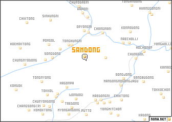
Sam-dong (Hamgyŏng, Korea, North)Sam-dong is a town in the Hamgyŏng region of Korea, North. An overview map of the region around Sam-dong is displayed below.
regional and 3d topo map of Sam-dong, Korea, North ::
Nearby towns ::
Hwidŏgi (3.4km east) //
T'onghŭng-ni (4.2km north west) //
T'ong-ni (4.5km north west) //
K'ŭnt'ong-gol (5.0km north west) //
Changp'yŏng-ni (6.3km north) //
Ŏp'yŏng-ni (6.6km north) //
Hagonp'a (6.6km south west) //
Changp'a-ri (6.8km north east) //
Song-dong (5.6km west) //
Ijŏndŏgi (8.5km south) //
Hŏmok-ch'on (8.6km south) //
Kŭmch'ang-ni (6.8km west) //
Pŏm-gol (7.2km north west) //
Suŭi-ri (7.3km north east) //
Songjŏng (7.4km south east) //
Maedŏng-ni (8.9km south) //
Mandŏng-nodongjagu (7.8km south east) //
Sangjangnae (8.6km south west) //
Pongsu-dong (9.3km south west) //
So-dong (9.7km south west) //
T'ok-kol (9.8km south west) //
Chik-tong (10.4km south east) //
[all distances 'as the bird flies' and approximate]  Places with similar names to Sam-dong, Korea, North ::
// Samadang (MM)
// Samdang (MM)
// Sam-tang (MM)
// Ciemiętniki (PL)
// Śmietanki (PL)
// Cimdenieki (LV)
// Samétienga (BF)
// Samtenga (BF)
// Sèmtenga (BF)
// Samudongo (CD)
Disclaimer :: Information on this page comes without warranty of any kind |
||
|
Where is Sam-dong? Elevation and coordinates ::
Latitude (lat): 40°39'25"N Longitude (lon): 128°29'13"E
Elevation (approx.): 602m (map arrows pan, magnifying glasses zoom) |
||
|
Visiting Sam-dong? Hotel/Accommodation ::
Book a hotel in Sam-dong Travel Guide ::
rental cars ::
car rental offers GPS waypoint ::
download a GPX waypoint (PoI) of Sam-dong for your GPS receiver
|
||