|
search place name
|
||
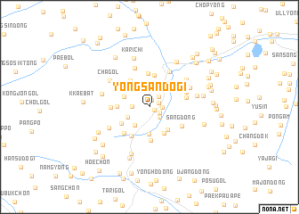
Yongsandŏgi (Hamgyŏng, Korea, North)Yongsandŏgi is a town in the Hamgyŏng region of Korea, North. An overview map of the region around Yongsandŏgi is displayed below.
regional and 3d topo map of Yongsandŏgi, Korea, North ::
Nearby towns ::
Sangjang-ni (0.6km south east) //
Unsajang (0.9km north) //
Hajang-dong (1.0km north east) //
Chungwŏl (1.2km south east) //
Hawŏl-li (1.3km east) //
Yongbal-lodongjagu (1.5km north east) //
Sangwŏl-tong (1.6km south east) //
Chungp'yŏng-dong (1.7km west) //
Taedŏk-tong (2.4km north) //
Kosŏng-ni (2.7km south west) //
Hanaep'o (2.4km south west) //
Hakhyŏn (3.2km north) //
Sohyŏn (3.4km south) //
Imyŏnsu-dong (2.7km north west) //
Chaedŏgi (3.3km south east) //
Sangsu-dong (3.4km north east) //
Kanp'o (3.6km south east) //
Sangnyegumi (4.0km north) //
Nosang (3.3km south west) //
Yo-gol (3.0km west) //
Sei-dong (3.8km north west) //
Yongdŏng-ni (4.2km north) //
Sosan (4.2km south) //
Yongso (4.1km south west) //
Ch'ŏngnyong-ni (4.0km south west) //
Sang-dong (3.9km south east) //
Paksun-dong (3.7km east) //
Sambat-kol (3.7km west) //
No-dong (4.0km north east) //
[all distances 'as the bird flies' and approximate]  Places with similar names to Yongsandŏgi, Korea, North :: Disclaimer :: Information on this page comes without warranty of any kind |
||
|
Where is Yongsandŏgi? Elevation and coordinates ::
Latitude (lat): 41°10'33"N Longitude (lon): 129°23'52"E
Elevation (approx.): 227m (map arrows pan, magnifying glasses zoom) |
||
|
Visiting Yongsandŏgi? Hotel/Accommodation ::
Book a hotel in Yongsandŏgi Travel Guide ::
rental cars ::
car rental offers GPS waypoint ::
download a GPX waypoint (PoI) of Yongsandŏgi for your GPS receiver
|
||