|
search place name
|
||
Segŏri-dong (Kyŏngsang, Korea, South)Segŏri-dong is a town in the Kyŏngsang region of Korea, South. An overview map of the region around Segŏri-dong is displayed below.
regional and 3d topo map of Segŏri-dong, Korea, South ::

Segŏri-dong airports ::
The nearest airport is KAG - Kangnung Gangneung, located 88.7 km north west of Segŏri-dong.
Other airports nearby include YEC - Yechon Yecheon (101.4 km south west), KPO - Pohang (116.0 km south), SHO - Sokch'o Sokcho (141.1 km north west), TAE - Taegu Daegu Ab (141.8 km south west), Nearby towns ::
Asan-dong (0.9km east) //
Kkoppang-dong (1.2km north east) //
Tondok-kol (1.0km south east) //
An-gol (1.3km north west) //
Tŭngmyŏng-dong (1.5km south east) //
Changni-gol (1.5km south west) //
Kowŏn-dong (2.0km south) //
Yongsŏ-dong (1.9km south west) //
Yongjae (1.9km south west) //
Muwŏl-tong (2.2km south) //
Chaeppŏmsang (2.2km north west) //
Makkŭm-dong (1.9km west) //
Saet'ŏ (2.0km south east) //
Kamnae-dong (2.4km north) //
Toch'ŏng-dong (2.2km south east) //
Sŏngnae-dong (2.4km north east) //
Paksil (2.1km north east) //
T'okkidari (2.3km north east) //
Wahyŏn-dong (2.6km south) //
Pŏmsang-gol (2.7km north) //
Tari-gol (2.3km west) //
Chŏngnim-dong (2.3km west) //
Pyŏlchang-dong (2.9km north) //
Yongjang-dong (3.0km north) //
P'yŏngjimal (2.5km north west) //
Koron-gol (2.5km south east) //
Kawŏn (3.1km south) //
Songjŏng (2.9km north east) //
Kokhae-dong (2.6km east) //
[all distances 'as the bird flies' and approximate] 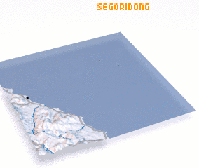 Places with similar names to Segŏri-dong, Korea, South ::
// Zagorodinka (RU)
// Schärding (AT)
// Schratteneck (AT)
// Schrauding (AT)
// Schröding (DE)
// Schrötting (DE)
// Skretting (NO)
// Skorodnica (PL)
// Skradnik (HR)
// Skradnik (CS)
Disclaimer :: Information on this page comes without warranty of any kind |
||
|
Where is Segŏri-dong? Elevation and coordinates ::
Latitude (lat): 37°1'58"N Longitude (lon): 129°22'36"E
Elevation (approx.): 47m (map arrows pan, magnifying glasses zoom) |
||
|
Visiting Segŏri-dong? Hotel/Accommodation ::
Book a hotel in Segŏri-dong Travel Guide ::
rental cars ::
car rental offers GPS waypoint ::
download a GPX waypoint (PoI) of Segŏri-dong for your GPS receiver
|
||