|
search place name
|
||
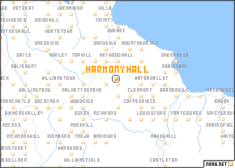
Harmony Hall (Saint Mary, Jamaica)Harmony Hall is a town in the Saint Mary region of Jamaica. An overview map of the region around Harmony Hall is displayed below.
regional and 3d topo map of Harmony Hall, Jamaica ::
Harmony Hall airports ::
The nearest airport is OCJ - Ocho Rios Boscobel, located 16.2 km north west of Harmony Hall.
Other airports nearby include KTP - Kingston Tinson Pen (33.2 km south), POT - Port Antonio Ken Jones (38.1 km east), KIN - Kingston Norman Manley Intl (39.8 km south), MBJ - Montego Bay Sangster Intl (111.5 km west), Nearby towns ::
Martin Village (NaNkm north) //
Cum See (NaNkm north) //
Content (1.9km south) //
The Cottage (1.9km south) //
Grantham (1.9km south) //
Highgate (1.9km south) //
Parsonage (1.9km south) //
Whitehall (1.9km north) //
Nonsuch (1.8km west) //
Lower Esher (2.6km south east) //
Charlottenburgh (3.7km south) //
Albany (3.5km east) //
Esher (3.5km east) //
Egypt (3.5km east) //
Salem (3.5km east) //
Heywood Hall (3.7km north) //
Clermont (4.0km south east) //
Islington (4.0km north east) //
Hampstead (4.0km north west) //
Ballards Valley (4.1km north west) //
Coffee Piece (5.1km south east) //
Friendship (5.1km north east) //
Langley (5.1km north west) //
Water Valley (5.3km east) //
Rosend (5.3km east) //
Berry Hill (5.3km west) //
Carron Hall (5.6km west) //
Belfield (5.6km east) //
Brae Head (5.6km west) //
[all distances 'as the bird flies' and approximate]  Places with similar names to Harmony Hall, Jamaica ::
// Harmony Hall (US)
// Harmony Hall (US)
// Harmony Hill (US)
// Harmony Hill (US)
// Harmony Hall (JM)
// Harmony Hall (JM)
// Harmony Hall (JM)
// Harmony Hill (JM)
// Harmony Hill (US)
// Harmony Hill (US)
Disclaimer :: Information on this page comes without warranty of any kind |
||
|
Where is Harmony Hall? Elevation and coordinates ::
Latitude (lat): 18°17'0"N Longitude (lon): 76°53'0"W
Elevation (approx.): 232m (map arrows pan, magnifying glasses zoom) |
||
|
Visiting Harmony Hall? Hotel/Accommodation ::
Book a hotel in Harmony Hall Travel Guide ::
Buy a travel guide for Jamaica rental cars ::
car rental offers GPS waypoint ::
download a GPX waypoint (PoI) of Harmony Hall for your GPS receiver
|
||