|
search place name
|
||
Smithville (Clarendon, Jamaica)Smithville is a town in the Clarendon region of Jamaica. An overview map of the region around Smithville is displayed below.
regional and 3d topo map of Smithville, Jamaica ::

Smithville airports ::
The nearest airport is OCJ - Ocho Rios Boscobel, located 53.9 km north east of Smithville.
Other airports nearby include KTP - Kingston Tinson Pen (58.8 km east), KIN - Kingston Norman Manley Intl (64.0 km east), MBJ - Montego Bay Sangster Intl (73.1 km north west), POT - Port Antonio Ken Jones (88.7 km east), Nearby towns ::
Smithville (1.8km west) //
Good Endeavour (1.8km east) //
Mount Cotterall (1.8km east) //
Corn Hill (2.6km north west) //
Endeavour (2.6km south west) //
Gloster (2.6km south west) //
Mount Nebo (2.6km south east) //
Thompson Town (2.6km south east) //
Holyland Corner (3.5km west) //
Effort (4.1km north west) //
Leicesterfields (4.1km north west) //
Boldness (4.1km south east) //
Montpelier (4.1km south east) //
Mount Moses (4.1km south east) //
Industry (5.1km north west) //
Mount Pleasant (5.1km south west) //
Minho (5.1km north east) //
Trout Hall (5.1km north east) //
Mears (5.1km north east) //
Frankfield (5.6km north) //
Guinea Corn (5.6km north) //
Richmond Park (5.6km south) //
Mount Lebanus (5.6km south) //
Peckham (5.8km north) //
Whitney (5.8km south) //
Mount Zion (5.6km east) //
Eden (5.8km south) //
Bowen Crawle (5.8km south) //
Crooked River (6.5km north east) //
[all distances 'as the bird flies' and approximate] 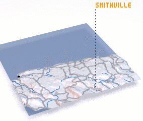 Places with similar names to Smithville, Jamaica ::
// Smithville (US)
// Smithville (US)
// Smithville (US)
// Smithville (US)
// Smithville (US)
// Smith Valley (US)
// Smithville (US)
// Smithville (US)
// Smithville (US)
// Smithville (US)
Disclaimer :: Information on this page comes without warranty of any kind |
||
|
Where is Smithville? Elevation and coordinates ::
Latitude (lat): 18°6'0"N Longitude (lon): 77°22'0"W
Elevation (approx.): 434m (map arrows pan, magnifying glasses zoom) |
||
|
Visiting Smithville? Hotel/Accommodation ::
Book a hotel in Smithville Travel Guide ::
Buy a travel guide for Jamaica rental cars ::
car rental offers GPS waypoint ::
download a GPX waypoint (PoI) of Smithville for your GPS receiver
|
||