|
search place name
|
||
Lasem (Laos)Lasem is a town in Laos. An overview map of the region around Lasem is displayed below.
regional and 3d topo map of Lasem, Laos ::

Lasem airports ::
The nearest airport is LPQ - Luang Prabang Luang Phabang Intl, located 201.7 km south of Lasem.
Nearby towns ::
Ban Houaylou (0.2km south west) //
Ban Sènsoukkha (1.5km south) //
Ban Kiou (2.5km east) //
Sen Bun (3.4km east) //
Ban Oudôm (3.5km west) //
Pong La (3.9km south west) //
Ban Phoulouangchan (4.6km east) //
Ban Hatko (5.4km south) //
Sen Panha (5.8km north) //
Ban Nam Sing (5.5km west) //
Sen Si (5.5km east) //
Thao Lông (5.8km south) //
Ban Laxam (5.8km south east) //
Ban Hatxông (6.0km west) //
Ban Namsa (6.8km north west) //
Ban Houadèng (7.1km north east) //
Ban Dokkham (7.7km south) //
Ban Hatxa (7.6km west) //
Houa Khan (8.2km north east) //
Tin Chay (8.2km north east) //
Ban Sala Theung (8.3km south east) //
Ban Sinxai (8.3km east) //
Ban Houangtaignè (8.3km east) //
Ban Phiaxaí (9.1km south east) //
Ban Sala-Loum (9.8km south east) //
[all distances 'as the bird flies' and approximate] 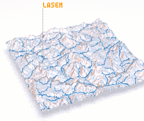 Places with similar names to Lasem, Laos ::
Disclaimer :: Information on this page comes without warranty of any kind |
||
|
Where is Lasem? Elevation and coordinates ::
Latitude (lat): 21°43'0"N Longitude (lon): 102°16'0"E
Elevation (approx.): 1006m (map arrows pan, magnifying glasses zoom) |
||
|
Visiting Lasem? Hotel/Accommodation ::
Book a hotel in Lasem Travel Guide ::
Buy a travel guide for Laos rental cars ::
car rental offers GPS waypoint ::
download a GPX waypoint (PoI) of Lasem for your GPS receiver
|
||