|
search place name
|
||
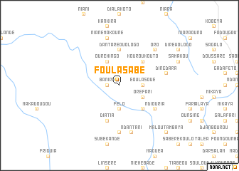
Foula Sabé (Mali)Foula Sabé is a town in Mali. An overview map of the region around Foula Sabé is displayed below.
regional and 3d topo map of Foula Sabé, Mali ::
Foula Sabé airports ::
The nearest airport is KGG - Kedougou, located 157.9 km west of Foula Sabé.
Other airports nearby include LEK - Labe (182.8 km south west), Nearby towns ::
Baniré (1.8km west) //
Eoula Soué (3.6km east) //
Félo (3.7km south) //
Ouréhingo (4.1km north west) //
Kouloun (4.1km south east) //
Oré Fari (4.1km south east) //
Kouroukouto (5.2km north east) //
Kéniéko (5.2km south east) //
Dantaré Ouologo (5.6km north) //
Diatia (5.8km south) //
Kouloun (6.6km south east) //
Ndiouria (6.6km south east) //
Linguéré (7.4km south) //
Dirédara (7.5km east) //
Ndantari (7.6km south) //
Nianémakouré (7.6km north) //
Oro (7.8km north east) //
Malou Tambaya (10.4km south east) //
[all distances 'as the bird flies' and approximate]  Places with similar names to Foula Sabé, Mali ::
Disclaimer :: Information on this page comes without warranty of any kind |
||
|
Where is Foula Sabé? Elevation and coordinates ::
Latitude (lat): 12°9'0"N Longitude (lon): 10°50'0"W
Elevation (approx.): 446m (map arrows pan, magnifying glasses zoom) |
||
|
Visiting Foula Sabé? Hotel/Accommodation ::
Book a hotel in Foula Sabé Travel Guide ::
Buy a travel guide for Mali rental cars ::
car rental offers GPS waypoint ::
download a GPX waypoint (PoI) of Foula Sabé for your GPS receiver
|
||