|
search place name
|
||
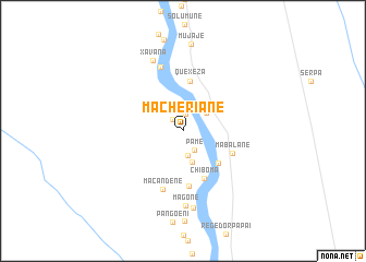
Macheriane (Gaza, Mozambique)Macheriane is a town in the Gaza region of Mozambique. An overview map of the region around Macheriane is displayed below.
regional and 3d topo map of Macheriane, Mozambique ::
Macheriane airports ::
The nearest airport is PHW - Phalaborwa, located 138.9 km west of Macheriane.
Other airports nearby include HDS - Hoedspruit Afb (167.2 km south west), SZK - Skukuza (174.1 km south west), Nearby towns ::
Chissicameli (1.5km north west) //
Matzacate (1.7km north) //
Pame (2.2km south east) //
Chidungane (2.6km south) //
Xixmulo (2.9km north east) //
Chefe Gacho (3.3km south) //
Maguge (4.7km south east) //
Quexeza (5.1km north) //
Chiboma (5.3km south) //
Mabalane (5.1km south east) //
Filomomi (5.7km south) //
Macandene (6.2km south) //
Zulo (6.8km north) //
Magone (7.7km south) //
Xavana (7.7km north) //
Madzezel (7.9km south) //
Mujaje (8.9km north) //
[all distances 'as the bird flies' and approximate]  Places with similar names to Macheriane, Mozambique ::
Disclaimer :: Information on this page comes without warranty of any kind |
||
|
Where is Macheriane? Elevation and coordinates ::
Latitude (lat): 23°36'47"S Longitude (lon): 32°28'17"E
Elevation (approx.): 84m (map arrows pan, magnifying glasses zoom) |
||
|
Visiting Macheriane? Hotel/Accommodation ::
Book a hotel in Macheriane Travel Guide ::
Buy a travel guide for Mozambique rental cars ::
car rental offers GPS waypoint ::
download a GPX waypoint (PoI) of Macheriane for your GPS receiver
|
||