|
search place name
|
||
Bitarebarebe (Papua New Guinea)Bitarebarebe is a town in Papua New Guinea. An overview map of the region around Bitarebarebe is displayed below.
regional and 3d topo map of Bitarebarebe, Papua New Guinea ::

Nearby towns ::
Vunabalbal (0.0km north) //
Vunamami (0.0km north) //
Ngatur (1.8km west) //
Karavi (1.9km north) //
Balanataman (2.6km north west) //
Bitalobo (2.6km north east) //
Ulagunan (2.6km south east) //
Ngunaguna (3.7km west) //
Kokopo (3.7km east) //
Ranguna (4.1km north west) //
Vunatagia (4.1km north west) //
Tingenavadu (4.1km south west) //
Ulaulatava (4.1km south west) //
Gunanba (4.1km south west) //
Nanuk (4.1km north west) //
Tinganalom (4.1km north west) //
Vunamurmur (5.2km north west) //
Ikongo Spring (5.2km south west) //
Kunakunai (5.5km west) //
Vunapope (5.5km east) //
Raluana (5.9km north) //
Barawon (5.9km north) //
Ialakua (6.7km north west) //
Malakuna (6.7km south west) //
Davaon (6.7km north west) //
Nguvalian (6.7km north west) //
Bitagalip (6.7km south east) //
Varzin (6.7km south west) //
Davaun (6.7km north east) //
[all distances 'as the bird flies' and approximate] 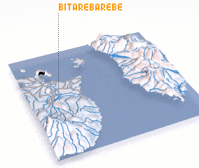 Places with similar names to Bitarebarebe, Papua New Guinea :: Disclaimer :: Information on this page comes without warranty of any kind |
||
|
Where is Bitarebarebe? Elevation and coordinates ::
Latitude (lat): 4°21'0"S Longitude (lon): 152°14'0"E
Elevation (approx.): 125m (map arrows pan, magnifying glasses zoom) |
||
|
Visiting Bitarebarebe? Hotel/Accommodation ::
Book a hotel in Bitarebarebe Travel Guide ::
rental cars ::
car rental offers GPS waypoint ::
download a GPX waypoint (PoI) of Bitarebarebe for your GPS receiver
|
||