|
search place name
|
||
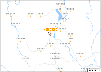
Kwia Kia (Papua New Guinea)Kwia Kia is a town in Papua New Guinea. An overview map of the region around Kwia Kia is displayed below.
regional and 3d topo map of Kwia Kia, Papua New Guinea ::
Kwia Kia airports ::
The nearest airport is HGU - Mount Hagen, located 97.5 km east of Kwia Kia.
Other airports nearby include GKA - Goroka (221.2 km east), Nearby towns ::
Angaruyle (1.9km north) //
Kaniana (3.7km south) //
Porgorali (4.1km north east) //
Angar Olye (4.1km north east) //
Iumbi Island (6.7km south east) //
Kinduli (6.7km south west) //
Pumbur (7.4km east) //
Kokas (7.6km east) //
Rumbipaga (7.6km south) //
Murlip (7.8km north east) //
Longap (8.3km north west) //
Mang (9.2km north east) //
Minjip (10.5km north west) //
[all distances 'as the bird flies' and approximate]  Places with similar names to Kwia Kia, Papua New Guinea ::
Disclaimer :: Information on this page comes without warranty of any kind |
||
|
Where is Kwia Kia? Elevation and coordinates ::
Latitude (lat): 5°47'0"S Longitude (lon): 143°25'0"E
Elevation (approx.): 2471m (map arrows pan, magnifying glasses zoom) |
||
|
Visiting Kwia Kia? Hotel/Accommodation ::
Book a hotel in Kwia Kia Travel Guide ::
rental cars ::
car rental offers GPS waypoint ::
download a GPX waypoint (PoI) of Kwia Kia for your GPS receiver
|
||