|
search place name
|
||
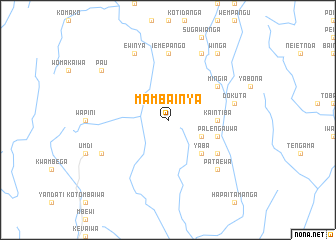
Mambainya (Papua New Guinea)Mambainya is a town in Papua New Guinea. An overview map of the region around Mambainya is displayed below.
regional and 3d topo map of Mambainya, Papua New Guinea ::
Mambainya airports ::
The nearest airport is LAE - Nadzab, located 131.6 km north east of Mambainya.
Other airports nearby include GKA - Goroka (169.9 km north west), POM - Port Moresby Jacksons Intl (254.4 km south east), HGU - Mount Hagen (262.8 km north west), Nearby towns ::
Ikoheawansun (4.1km south east) //
Yaba (5.2km south east) //
Kaintiba (5.5km east) //
Yakitanwa (5.5km east) //
Palengauwa (5.8km east) //
Hapataewa (6.6km south east) //
Mingia (6.6km north east) //
Iemepango (7.4km north) //
Dokuta (7.6km east) //
Pataewa (7.8km south east) //
Ikueiya (8.2km south west) //
Iwambe (8.2km south west) //
Ewinya (8.3km north west) //
Kaingo (8.3km north east) //
Pau (9.2km north west) //
Winga (9.2km north east) //
[all distances 'as the bird flies' and approximate]  Places with similar names to Mambainya, Papua New Guinea ::
// Memonya (GH)
// Mamunye (UG)
// Mumbanyu (ZM)
// Mowmenīyeh (IR)
// Mumāniya (PK)
// Maʼmūnīyeh (IR)
// Maméniye (CM)
Disclaimer :: Information on this page comes without warranty of any kind |
||
|
Where is Mambainya? Elevation and coordinates ::
Latitude (lat): 7°30'0"S Longitude (lon): 145°59'0"E
Elevation (approx.): 1132m (map arrows pan, magnifying glasses zoom) |
||
|
Visiting Mambainya? Hotel/Accommodation ::
Book a hotel in Mambainya Travel Guide ::
rental cars ::
car rental offers GPS waypoint ::
download a GPX waypoint (PoI) of Mambainya for your GPS receiver
|
||