|
search place name
|
||
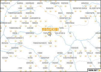
Mangkibi (Papua New Guinea)Mangkibi is a town in Papua New Guinea. An overview map of the region around Mangkibi is displayed below.
regional and 3d topo map of Mangkibi, Papua New Guinea ::
Mangkibi airports ::
The nearest airport is GKA - Goroka, located 29.5 km north east of Mangkibi.
Other airports nearby include HGU - Mount Hagen (111.3 km north west), MAG - Madang (134.1 km north east), LAE - Nadzab (172.1 km east), Nearby towns ::
Dereperengwa (1.9km south) //
Yanemegori (1.9km south) //
Kabutine (1.9km north) //
Tari (1.8km west) //
Kariwiri (1.8km west) //
Kirino (1.8km west) //
Wasimegu (2.6km south east) //
Iandine (2.6km north east) //
Sua (3.7km south) //
Miori (3.7km south) //
Bimeri (3.7km south) //
Mulefagu (3.7km east) //
Ainagu (4.1km south east) //
Marepa (4.1km north east) //
Fokoi (4.1km north east) //
Emeregam Number 2 (4.1km north west) //
Tabie Number 2 (5.2km south west) //
Goro (5.2km south west) //
Koi (5.2km south west) //
Kiragu (5.5km west) //
Sauri (5.5km west) //
Aremaku (5.9km north) //
Keougu (6.7km north west) //
Lambau (6.7km north east) //
Norio (6.7km north west) //
Sagio (6.7km north west) //
Kuamu (6.7km north east) //
Nambaiyufa (6.7km north east) //
Uganagu (7.4km west) //
[all distances 'as the bird flies' and approximate] 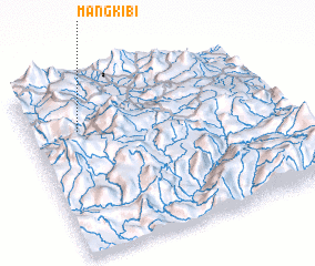 Places with similar names to Mangkibi, Papua New Guinea ::
Disclaimer :: Information on this page comes without warranty of any kind |
||
|
Where is Mangkibi? Elevation and coordinates ::
Latitude (lat): 6°16'0"S Longitude (lon): 145°12'0"E
Elevation (approx.): 2176m (map arrows pan, magnifying glasses zoom) |
||
|
Visiting Mangkibi? Hotel/Accommodation ::
Book a hotel in Mangkibi Travel Guide ::
rental cars ::
car rental offers GPS waypoint ::
download a GPX waypoint (PoI) of Mangkibi for your GPS receiver
|
||