|
search place name
|
||
Dentiste (Ouest, Haiti)Dentiste is a town in the Ouest region of Haiti. An overview map of the region around Dentiste is displayed below.
regional and 3d topo map of Dentiste, Haiti ::

Dentiste airports ::
The nearest airport is PAP - Port-au-prince Toussaint Louverture Intl, located 61.8 km north east of Dentiste.
Other airports nearby include CAP - Cap Haitien Intl (165.5 km north east), BRX - Barahona Maria Montez Intl (181.5 km east), BCA - Baracoa Playa Gustavo Rizo (282.5 km north west), Nearby towns ::
Potier (1.9km north) //
Durissy (1.9km north) //
Vally (1.8km east) //
Rosinde (1.9km south) //
Clairin (2.1km west) //
Coulon (2.6km north east) //
Dupuy (2.6km north west) //
Varreux (2.6km north west) //
Conotte (2.6km south west) //
Thérese (2.6km south west) //
Fond Gérard (3.4km south west) //
Vali (3.4km east) //
Béatre (3.7km north) //
Bourdeau (3.7km north) //
Diara (3.7km north) //
Corail Lacora (3.5km east) //
Bruand (3.5km west) //
Depaluce (3.5km west) //
Nan Pale (3.7km south) //
Box Indis (3.7km south) //
Bois Jeanay (4.1km north east) //
Capaca (4.1km north east) //
Tenneau (4.0km north east) //
Doucet (4.1km north west) //
Grande Savane (4.0km south east) //
Méance (4.0km south east) //
Grand Bois (4.0km north west) //
Marcan (4.0km north west) //
Marouge (4.1km south east) //
[all distances 'as the bird flies' and approximate] 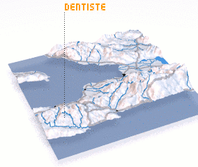 Places with similar names to Dentiste, Haiti ::
// Dindeşti (RO)
// Ţinteşti (RO)
// Ţonteşti (RO)
// Tent City (US)
// Tandoust (MA)
// T'un-tzu-t'ou (TW)
// T'ien-tzu-ti (TW)
// Danaodaisidui (CN)
// Tandzut (AM)
// Tandzut (AM)
Disclaimer :: Information on this page comes without warranty of any kind |
||
|
Where is Dentiste? Elevation and coordinates ::
Latitude (lat): 18°22'0"N Longitude (lon): 72°50'0"W
Elevation (approx.): 1058m (map arrows pan, magnifying glasses zoom) |
||
|
Visiting Dentiste? Hotel/Accommodation ::
Book a hotel in Dentiste Travel Guide ::
Buy a travel guide for Haiti rental cars ::
car rental offers GPS waypoint ::
download a GPX waypoint (PoI) of Dentiste for your GPS receiver
|
||