|
search place name
|
||
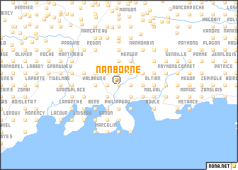
Nan Borne (Sud, Haiti)Nan Borne is a town in the Sud region of Haiti. An overview map of the region around Nan Borne is displayed below.
regional and 3d topo map of Nan Borne, Haiti ::
Nan Borne airports ::
The nearest airport is PAP - Port-au-prince Toussaint Louverture Intl, located 140.3 km east of Nan Borne.
Other airports nearby include CAP - Cap Haitien Intl (217.1 km north east), GAO - Guantanamo Mariana Grajales (259.3 km north west), Nearby towns ::
Nan Jonc (NaNkm north) //
Zombi (NaNkm north) //
Terre Neuve (1.8km east) //
Minor Pays (1.8km east) //
Cassamajor (1.8km west) //
Clement (1.9km north) //
Jalousie (1.9km north) //
Bas Dufort (2.6km south east) //
Solon (2.6km south west) //
La Sucrerie Henry (2.6km north east) //
Chaterie (2.6km north west) //
Gros Morne (2.6km north west) //
Philippeau (3.7km south) //
Marcel (3.5km east) //
Valbrune (3.5km west) //
Morne Zoranger (3.5km west) //
La Congo (3.7km north) //
Grande Savane (4.1km south east) //
Saint-Louis du Sud (4.0km south east) //
La Source (4.1km south west) //
Frerel (4.0km north east) //
Corail Henry (4.0km north east) //
Malvezier (4.0km north east) //
Merger (4.1km north east) //
Crapa (4.0km north west) //
Béré (5.1km south west) //
Lundy (5.6km south) //
Coq (5.6km south) //
Chaumette (5.6km south) //
[all distances 'as the bird flies' and approximate]  Places with similar names to Nan Borne, Haiti ::
// Nan Borrin (HT)
Disclaimer :: Information on this page comes without warranty of any kind |
||
|
Where is Nan Borne? Elevation and coordinates ::
Latitude (lat): 18°17'0"N Longitude (lon): 73°35'0"W
Elevation (approx.): 43m (map arrows pan, magnifying glasses zoom) |
||
|
Visiting Nan Borne? Hotel/Accommodation ::
Book a hotel in Nan Borne Travel Guide ::
Buy a travel guide for Haiti rental cars ::
car rental offers GPS waypoint ::
download a GPX waypoint (PoI) of Nan Borne for your GPS receiver
|
||