|
search place name
|
||
Bamunugama (North Western, Sri Lanka)Bamunugama is a town in the North Western region of Sri Lanka. An overview map of the region around Bamunugama is displayed below.
regional and 3d topo map of Bamunugama, Sri Lanka ::

Bamunugama airports ::
The nearest airport is CMB - Bandaranaike Intl Colombo, located 83.1 km south west of Bamunugama.
Other airports nearby include RML - Colombo Ratmalana (117.2 km south west), TRR - Trinciomalee China Bay (125.4 km north east), GOY - Galoya Amparai (150.9 km east), Nearby towns ::
Karambe (0.0km north) //
Hunnaggama (0.0km north) //
Metiyakgama (0.0km north) //
Siyambalagaswewa (1.9km south) //
Ambagassewa (1.9km south) //
Moragaswewa (1.9km south) //
Helogama (1.8km west) //
Wetiyagedara (1.8km east) //
Pidiwilla (1.8km east) //
Kadambawa (1.9km north) //
Radamigassewa (1.9km north) //
Talagalla (2.6km south west) //
Tammitagama (2.6km south west) //
Kaluarachchiyagama (2.6km south east) //
Wegedaragama (2.6km south east) //
Medagama (2.6km south east) //
Bamunakotuwa (2.6km north west) //
Embogama (2.6km north west) //
Konwegama (2.6km north west) //
Ratmalakotuwa (2.6km north west) //
Godahitigama (2.6km north west) //
Yatakalanegama (2.6km north west) //
Niyandawane (2.6km north east) //
Kulasendawa (2.6km north east) //
Rathmale (3.3km south) //
Unagaswewa (3.7km south) //
Nekatiratmale (3.7km south) //
Timbiriyagedara (3.7km west) //
Galewewa (3.7km west) //
[all distances 'as the bird flies' and approximate] 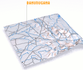 Places with similar names to Bamunugama, Sri Lanka ::
// Bamenkombo (CM)
// Bambangoumba (ML)
// Bammanegama (LK)
// Bammannegama (LK)
// Bamunugama (LK)
// Bamunugama (LK)
// Bamunugama (LK)
// Bamunugama (LK)
// Bamunugama (LK)
// Bamunugama (LK)
Disclaimer :: Information on this page comes without warranty of any kind |
||
|
Where is Bamunugama? Elevation and coordinates ::
Latitude (lat): 7°47'0"N Longitude (lon): 80°20'0"E
Elevation (approx.): 102m (map arrows pan, magnifying glasses zoom) |
||
|
Visiting Bamunugama? Hotel/Accommodation ::
Book a hotel in Bamunugama Travel Guide ::
Buy a travel guide for Sri Lanka rental cars ::
car rental offers GPS waypoint ::
download a GPX waypoint (PoI) of Bamunugama for your GPS receiver
|
||