|
search place name
|
||
Imbulpe (Sabaragamuwa, Sri Lanka)Imbulpe is a town in the Sabaragamuwa region of Sri Lanka. An overview map of the region around Imbulpe is displayed below.
regional and 3d topo map of Imbulpe, Sri Lanka ::

Imbulpe airports ::
The nearest airport is RML - Colombo Ratmalana, located 94.6 km west of Imbulpe.
Other airports nearby include CMB - Bandaranaike Intl Colombo (107.9 km north west), GOY - Galoya Amparai (121.2 km north east), TRR - Trinciomalee China Bay (209.3 km north), Nearby towns ::
Koswinna (0.0km north) //
Alutnuwara (1.2km south east) //
Migahawatta (1.8km west) //
Helawatta (1.8km west) //
Passaramulla (1.8km west) //
Maddetalawa (1.8km west) //
Yahalekumbura (1.8km west) //
Amuwatugoda (1.8km west) //
Medagedaragoda (1.9km south) //
Urabokka (1.8km east) //
Tenna (1.8km east) //
Asseddungoda (1.8km east) //
Karape (1.8km east) //
Nawala (2.6km south west) //
Kumbalmulla (2.6km south west) //
Naluwela (2.6km south west) //
Udagangoda (2.6km south west) //
Halwinna (2.6km south west) //
Denagama (2.6km north west) //
Bogahakumburuwela (2.6km north east) //
Kumbukwala (2.6km south east) //
Pilipota (2.6km south east) //
Silanarawa (3.2km west) //
Nelliwala (3.7km west) //
Galenda (3.7km west) //
Etawakwala (3.7km west) //
Kurupanawela (3.7km west) //
Udawela (3.7km west) //
Welanhinna (3.7km south) //
[all distances 'as the bird flies' and approximate] 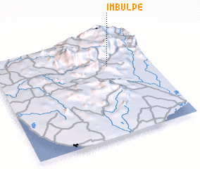 Places with similar names to Imbulpe, Sri Lanka :: Disclaimer :: Information on this page comes without warranty of any kind |
||
|
Where is Imbulpe? Elevation and coordinates ::
Latitude (lat): 6°42'0"N Longitude (lon): 80°44'0"E
Elevation (approx.): 495m (map arrows pan, magnifying glasses zoom) |
||
|
Visiting Imbulpe? Hotel/Accommodation ::
Book a hotel in Imbulpe Travel Guide ::
Buy a travel guide for Sri Lanka rental cars ::
car rental offers GPS waypoint ::
download a GPX waypoint (PoI) of Imbulpe for your GPS receiver
|
||