|
search place name
|
||
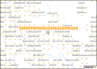
Naranpanawa Disaneggammedda (Central, Sri Lanka)Naranpanawa Disaneggammedda is a town in the Central region of Sri Lanka. An overview map of the region around Naranpanawa Disaneggammedda is displayed below.
regional and 3d topo map of Naranpanawa Disaneggammedda, Sri Lanka ::
Naranpanawa Disaneggammedda airports ::
The nearest airport is CMB - Bandaranaike Intl Colombo, located 93.5 km west of Naranpanawa Disaneggammedda.
Other airports nearby include GOY - Galoya Amparai (100.4 km east), RML - Colombo Ratmalana (107.8 km south west), TRR - Trinciomalee China Bay (142.8 km north), Nearby towns ::
Naranpanawa Karagastenna (1.8km east) //
Karagastenna (1.8km east) //
Attaragalla (1.9km south) //
Naranpanawa Dembatagolla (1.9km north) //
Udagama Pallegama (1.9km north) //
Udagama (1.8km west) //
Pallegama Pahalagammedda (1.8km west) //
Wavinna (1.8km west) //
Naranpanawa (1.9km north east) //
Gankewala (2.6km south east) //
Wepatana (2.6km south east) //
Gomagoda (2.6km south east) //
Naranpanawa Egodagammedda (2.6km north east) //
Naranpanawa Kandegammedda (2.6km north east) //
Pitawela (2.6km south west) //
Ittamalliyagoda (2.6km south west) //
Hurikaduwa (2.6km south west) //
Hurikaduwe Madige (2.6km south west) //
Menikhinna (2.6km south west) //
Gedarawela (2.6km south west) //
Udagama (2.6km north west) //
Watapana (3.7km east) //
Kengalla (3.7km south) //
Panwila (3.7km north) //
Walala Megodagammedda (3.7km west) //
Pallegama Ihalagammedda (3.7km west) //
Pitiyegedara (3.7km west) //
Wattegama (3.8km north west) //
Karalliyadda (4.1km south east) //
[all distances 'as the bird flies' and approximate]  Places with similar names to Naranpanawa Disaneggammedda, Sri Lanka :: Disclaimer :: Information on this page comes without warranty of any kind |
||
|
Where is Naranpanawa Disaneggammedda? Elevation and coordinates ::
Latitude (lat): 7°20'0"N Longitude (lon): 80°43'0"E
Elevation (approx.): 819m (map arrows pan, magnifying glasses zoom) |
||
|
Visiting Naranpanawa Disaneggammedda? Hotel/Accommodation ::
Book a hotel in Naranpanawa Disaneggammedda Travel Guide ::
Buy a travel guide for Sri Lanka rental cars ::
car rental offers GPS waypoint ::
download a GPX waypoint (PoI) of Naranpanawa Disaneggammedda for your GPS receiver
|
||