|
search place name
|
||
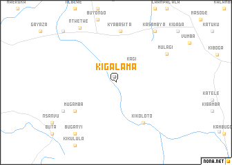
Kigalama (Kiboga, Uganda)Kigalama is a town in the Kiboga region of Uganda. An overview map of the region around Kigalama is displayed below.
regional and 3d topo map of Kigalama, Uganda ::
Kigalama airports ::
The nearest airport is EBB - Entebbe Intl, located 129.4 km south east of Kigalama.
Other airports nearby include BUX - Bunia (174.1 km north west), SRT - Soroti (241.3 km north east), Nearby towns ::
Kagi (3.8km north east) //
Kikoloto (7.9km south east) //
Mugamba (8.1km south west) //
Kyabasita (8.3km north) //
Mulagi (9.4km north east) //
Kigondo (9.7km south west) //
Kasambya (10.4km north east) //
Ntwetwe (10.6km north west) //
Buganyi (10.7km south west) //
Ndibata (11.9km north west) //
[all distances 'as the bird flies' and approximate] 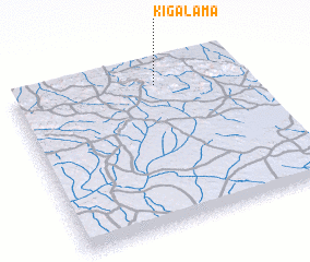 Places with similar names to Kigalama, Uganda ::
// Gqoloma (ZA)
// Kikilma (BF)
// Kiakalamu (CD)
// Kiakulimba (CD)
// Cacalomé (MX)
// Kagalama (UG)
// Kigalama (UG)
// Kigalambi (UG)
// Gouakoloma (ML)
// Caicoloma (BO)
Disclaimer :: Information on this page comes without warranty of any kind |
||
|
Where is Kigalama? Elevation and coordinates ::
Latitude (lat): 0°52'31"S Longitude (lon): 31°37'36"E
Elevation (approx.): 1142m (map arrows pan, magnifying glasses zoom) |
||
|
Visiting Kigalama? Hotel/Accommodation ::
Book a hotel in Kigalama Travel Guide ::
Buy a travel guide for Uganda rental cars ::
car rental offers GPS waypoint ::
download a GPX waypoint (PoI) of Kigalama for your GPS receiver
|
||