|
search place name
|
||
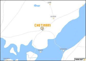
Chétimari (Diffa, Niger)Chétimari is a town in the Diffa region of Niger. An overview map of the region around Chétimari is displayed below.
regional and 3d topo map of Chétimari, Niger ::
Chétimari airports ::
The nearest airport is MIU - Maiduguri, located 163.4 km south east of Chétimari.
Nearby towns ::
Deïssa (7.0km north east) //
[all distances 'as the bird flies' and approximate]  Places with similar names to Chétimari, Niger ::
// Shadowmoor (US)
// Chedia Mare (RO)
// Shademoore (US)
// Chhati Miāri (IN)
// Chittāmūr (IN)
// Shadymyr (KG)
// Chidiamero (ZM)
// Shād Mehr (IR)
// Chato Marri (PK)
// Chhatta Mori (PK)
Disclaimer :: Information on this page comes without warranty of any kind |
||
|
Where is Chétimari? Elevation and coordinates ::
Latitude (lat): 13°11'6"N Longitude (lon): 12°25'31"E
Elevation (approx.): 312m (map arrows pan, magnifying glasses zoom) |
||
|
Visiting Chétimari? Hotel/Accommodation ::
Book a hotel in Chétimari Travel Guide ::
Buy a travel guide for Niger rental cars ::
car rental offers GPS waypoint ::
download a GPX waypoint (PoI) of Chétimari for your GPS receiver
|
||