|
search place name
|
||
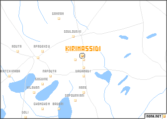
Kirimassidi (Zinder, Niger)Kirimassidi is a town in the Zinder region of Niger. An overview map of the region around Kirimassidi is displayed below.
regional and 3d topo map of Kirimassidi, Niger ::
Kirimassidi airports ::
The nearest airport is ZND - Zinder, located 131.4 km south of Kirimassidi.
Other airports nearby include AJY - Agadez Manu Dayak (245.0 km north west), MFG - Maradi (257.7 km south west), Nearby towns ::
 Places with similar names to Kirimassidi, Niger ::
// Grimisuat (CH)
// Grimzdai (LT)
// Grămeşti (RO)
// Keramzit (RU)
// Cream City (US)
// Guarimacito (CO)
// Karamsad (IN)
// Karm Saddé (LB)
// Karam Bast (IR)
// Kārmozd (IR)
Disclaimer :: Information on this page comes without warranty of any kind |
||
|
Where is Kirimassidi? Elevation and coordinates ::
Latitude (lat): 14°58'0"N Longitude (lon): 8°59'0"E
Elevation (approx.): 539m (map arrows pan, magnifying glasses zoom) |
||
|
Visiting Kirimassidi? Hotel/Accommodation ::
Book a hotel in Kirimassidi Travel Guide ::
Buy a travel guide for Niger rental cars ::
car rental offers GPS waypoint ::
download a GPX waypoint (PoI) of Kirimassidi for your GPS receiver
|
||