|
search place name
|
||
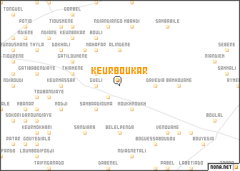
Keur Boukar (Louga, Senegal)Keur Boukar is a town in the Louga region of Senegal. An overview map of the region around Keur Boukar is displayed below.
regional and 3d topo map of Keur Boukar, Senegal ::
Keur Boukar airports ::
The nearest airport is XLS - St. Louis Saint Louis, located 96.1 km north west of Keur Boukar.
Other airports nearby include KLC - Kaolack (148.5 km south), DKR - Dakar Leopold Sedar Senghor Intl (198.7 km south west), Nearby towns ::
Loumbi Laoubé (2.6km south west) //
Guéli (3.6km west) //
Dokhali (4.0km north west) //
Moukh Moukh (4.1km south east) //
Samba Adiouma (5.1km south west) //
Boguelbar (5.1km south west) //
Ali Ndènè (5.6km north) //
Davédia (5.4km east) //
Mahafar (6.6km north west) //
Bélel Penda (7.4km south) //
Thiamène (7.4km west) //
Ahibdia (7.7km north west) //
Bouli (8.2km north west) //
Gati Loumène (8.0km north west) //
Sandiara (9.1km south west) //
Keur Bakar (10.3km north west) //
Vénouamé (10.3km south east) //
[all distances 'as the bird flies' and approximate] 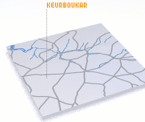 Places with similar names to Keur Boukar, Senegal ::
// Karabakır (TR)
// Garbakaray (RU)
// Garbey Gorou (NE)
// Garbey Gorou (NE)
// Garbey Kourou (NE)
// Guiro Bokari (SN)
// Keur Bakar (SN)
// Keur Bakar (SN)
// Keur Bakar (SN)
// Keur Bakari (SN)
Disclaimer :: Information on this page comes without warranty of any kind |
||
|
Where is Keur Boukar? Elevation and coordinates ::
Latitude (lat): 15°28'0"N Longitude (lon): 15°48'0"W
Elevation (approx.): 48m (map arrows pan, magnifying glasses zoom) |
||
|
Visiting Keur Boukar? Hotel/Accommodation ::
Book a hotel in Keur Boukar Travel Guide ::
Buy a travel guide for Senegal rental cars ::
car rental offers GPS waypoint ::
download a GPX waypoint (PoI) of Keur Boukar for your GPS receiver
|
||