|
search place name
|
||
Veltiennkou (Kaolack, Senegal)Veltiennkou is a town in the Kaolack region of Senegal. An overview map of the region around Veltiennkou is displayed below.
regional and 3d topo map of Veltiennkou, Senegal ::

Veltiennkou airports ::
The nearest airport is KLC - Kaolack, located 82.6 km north west of Veltiennkou.
Other airports nearby include BJL - Banjul Intl (145.9 km west), ZIG - Ziguinchor (167.1 km south west), TUD - Tambacounda (187.2 km east), BXO - Bissau Oswaldo Vieira Intl (211.0 km south), Nearby towns ::
Kilimane (2.6km north west) //
Ker Jah (3.7km south) //
Ker Malick Abdou Njie (3.7km south) //
Jimbala Fel NʼGoh (3.7km south) //
Diama Gadio (3.6km west) //
Diemballa Ker Musa (4.1km south west) //
Ker Madi (4.1km south west) //
Ker Jaho (4.1km south west) //
Ker Tiern (4.1km south west) //
Diemballa Ker Cherno (4.1km south west) //
Ker Jah (4.1km south west) //
Sintiou Kilimane (4.1km north west) //
Diokoul (4.1km north west) //
Diemballa (5.2km south west) //
Diama Guène (5.4km west) //
Hamdalaye (5.6km north) //
Jimbala Ker Kara (5.6km south) //
Pelngo (5.6km south) //
Ker Musa (5.6km south) //
Genge Tukulor (5.6km south) //
Gui Jahanka (5.6km south) //
Ker Ibra (5.6km south) //
Jimbala Ker Chandou (5.6km south) //
Ndankou (5.8km north) //
Ker Chaindu (5.7km east) //
Diemballa Ker Madi (5.8km south) //
Simbara Kai (6.6km south east) //
Pimak (6.5km south east) //
Simbara Ngor (6.6km south east) //
[all distances 'as the bird flies' and approximate] 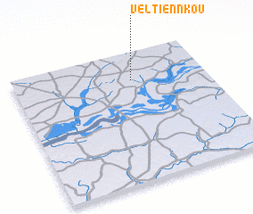 Places with similar names to Veltiennkou, Senegal ::
// Falting (AT)
// Fielding (US)
// Vladnica (BA)
// Valea Adîncă (RO)
// Vladnic (RO)
// Villadonga (ES)
// Fielding (US)
// Fal Dioung (SN)
// Fielding (CA)
// Valão da Onça (BR)
Disclaimer :: Information on this page comes without warranty of any kind |
||
|
Where is Veltiennkou? Elevation and coordinates ::
Latitude (lat): 13°47'0"N Longitude (lon): 15°23'0"W
Elevation (approx.): 47m (map arrows pan, magnifying glasses zoom) |
||
|
Visiting Veltiennkou? Hotel/Accommodation ::
Book a hotel in Veltiennkou Travel Guide ::
Buy a travel guide for Senegal rental cars ::
car rental offers GPS waypoint ::
download a GPX waypoint (PoI) of Veltiennkou for your GPS receiver
|
||