|
search place name
|
||
Mutumbaetwa (Western, Zambia)Mutumbaetwa is a town in the Western region of Zambia. An overview map of the region around Mutumbaetwa is displayed below.
regional and 3d topo map of Mutumbaetwa, Zambia ::
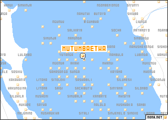
Nearby towns ::
Lisulo (0.0km north) //
Muleme (1.8km west) //
Samutumwa (1.8km west) //
Imanga (1.9km north) //
Shuwanga (1.9km north) //
Nayoya (1.9km south) //
Simwenewa (1.9km south) //
Imanga (1.8km east) //
Mpongo (1.8km east) //
Lisima (1.8km east) //
Mamochisane (2.6km north west) //
Natamoyo (2.6km north west) //
Muwana (2.6km south west) //
Akawi (2.6km south west) //
Yutanga (3.6km west) //
Wasamuku (3.6km west) //
Katama (3.7km north) //
Imanga (3.7km south) //
Mungongo (3.7km south) //
Namunda (4.1km north west) //
Lukalanya (4.1km north west) //
Imwangala (4.1km north west) //
Nengo (4.1km south west) //
Santase (4.1km south west) //
Sunga (4.1km south west) //
Kakwete (4.0km south west) //
Akokwa (4.0km south west) //
Matindo (4.0km north west) //
Munyembeza (4.0km south east) //
[all distances 'as the bird flies' and approximate] 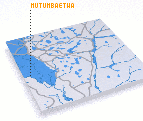 Places with similar names to Mutumbaetwa, Zambia :: Disclaimer :: Information on this page comes without warranty of any kind |
||
|
Where is Mutumbaetwa? Elevation and coordinates ::
Latitude (lat): 15°27'0"S Longitude (lon): 23°5'0"E
Elevation (approx.): 1010m (map arrows pan, magnifying glasses zoom) |
||
|
Visiting Mutumbaetwa? Hotel/Accommodation ::
Book a hotel in Mutumbaetwa Travel Guide ::
Buy a travel guide for Zambia rental cars ::
car rental offers GPS waypoint ::
download a GPX waypoint (PoI) of Mutumbaetwa for your GPS receiver
|
||