|
search place name
|
||
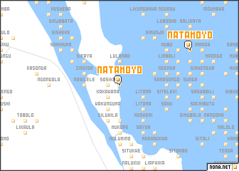
Natamoyo (Western, Zambia)Natamoyo is a town in the Western region of Zambia. An overview map of the region around Natamoyo is displayed below.
regional and 3d topo map of Natamoyo, Zambia ::
Nearby towns ::
Moto (0.0km north) //
Katama (0.0km north) //
Kanga (1.8km west) //
Sosiku (1.8km west) //
Imanga (2.6km south west) //
Kakawana (2.6km south west) //
Lulambo (3.7km north) //
Litoma (4.0km south east) //
Kasanga (4.1km south west) //
Sitali (4.1km south west) //
Namanga (4.1km south west) //
Pilola (4.1km south west) //
Wakunguma (4.1km south west) //
Litoma (5.1km south east) //
Silitongwana (5.4km west) //
Imukusi (5.6km south) //
Kaliki (5.4km west) //
Lubasi (5.6km south) //
Lukesha (5.4km west) //
Nasilele (5.4km west) //
Nalopu (5.7km east) //
Like (5.7km west) //
Muyoyo (5.7km west) //
Siwisha (5.7km west) //
Zingisa (5.7km west) //
Siluwila (5.8km south) //
Mubita (5.8km south) //
Mushemi (6.6km south east) //
Nyambe (6.5km north west) //
[all distances 'as the bird flies' and approximate] 
Disclaimer :: Information on this page comes without warranty of any kind |
||
|
Where is Natamoyo? Elevation and coordinates ::
Latitude (lat): 15°29'0"S Longitude (lon): 22°58'0"E
Elevation (approx.): 1011m (map arrows pan, magnifying glasses zoom) |
||
|
Visiting Natamoyo? Hotel/Accommodation ::
Book a hotel in Natamoyo Travel Guide ::
Buy a travel guide for Zambia rental cars ::
car rental offers GPS waypoint ::
download a GPX waypoint (PoI) of Natamoyo for your GPS receiver
|
||