|
search place name
|
||
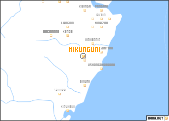
Mikunguni (Tanzania)Mikunguni is a town in Tanzania. An overview map of the region around Mikunguni is displayed below.
regional and 3d topo map of Mikunguni, Tanzania ::
Mikunguni airports ::
The nearest airport is TGT - Tanga, located 51.1 km north of Mikunguni.
Other airports nearby include ZNZ - Zanzibar (82.7 km south east), PMA - Pemba (102.0 km east), DAR - Dar Es Salaam Mwalimu Julius K Nyerere Intl (151.7 km south), MBA - Mombasa Moi Intl (181.2 km north east), Nearby towns ::
Mwera (0.0km north) //
Kambania (4.1km north east) //
Ushongo Mtoni (4.1km north east) //
Ushongo Mabaoni (4.1km south east) //
Simuni (5.6km south) //
Kenge (6.7km north west) //
Kidifu (7.6km north) //
Langoni (8.3km north west) //
Minazini (8.3km north east) //
Kinyafungo (8.3km north east) //
Makarane (9.2km north west) //
Sakura (9.3km south west) //
[all distances 'as the bird flies' and approximate]  Places with similar names to Mikunguni, Tanzania ::
// Maconacon (PH)
// Magungunay (PH)
// Makongani (KE)
// Mkongani (KE)
// Mkunguni (KE)
// Mukunguni (KE)
// Makangonio (GA)
// Mukangani (ZM)
// Makongoni (TZ)
// Mgongoni (TZ)
Disclaimer :: Information on this page comes without warranty of any kind |
||
|
Where is Mikunguni? Elevation and coordinates ::
Latitude (lat): 5°32'0"S Longitude (lon): 38°56'0"E
Elevation (approx.): 41m (map arrows pan, magnifying glasses zoom) |
||
|
Visiting Mikunguni? Hotel/Accommodation ::
Book a hotel in Mikunguni Travel Guide ::
Buy a travel guide for Tanzania rental cars ::
car rental offers GPS waypoint ::
download a GPX waypoint (PoI) of Mikunguni for your GPS receiver
|
||