|
search place name
|
||
Putahun (Eastern, Sierra Leone)Putahun is a town in the Eastern region of Sierra Leone. An overview map of the region around Putahun is displayed below.
regional and 3d topo map of Putahun, Sierra Leone ::

Putahun airports ::
The nearest airport is MLW - Monrovia Spriggs Payne, located 188.8 km south of Putahun.
Other airports nearby include ROB - Monrovia Roberts Intl (207.1 km south), Nearby towns ::
Gelahun (2.9km west) //
Jomu (3.1km south east) //
Komaru (3.5km north) //
Naiagolehun (3.5km south west) //
Gerehun (3.7km north) //
Naiahun (3.7km north) //
Sami (3.8km south west) //
Gnanyahun Bulima (4.3km north west) //
Bongama (4.5km north east) //
Gangama (4.5km north east) //
Taninahun (4.7km north west) //
Baoma (4.7km north west) //
Nyandeama (4.8km east) //
Nekabu (5.0km south east) //
Sami (5.5km east) //
Sagwehun (5.6km south east) //
Bongbu (5.6km north) //
Bambawo (6.0km north west) //
Jerihun (6.0km north west) //
Wunde (6.1km north east) //
Guama (6.3km north west) //
Gegwema (6.2km east) //
Gbaru (6.6km south) //
Gbandorma (6.9km west) //
Mano-Kotuhun (7.1km north east) //
Dia (7.1km south east) //
Talia (7.4km south west) //
Koye (7.4km north) //
Gandorhun (7.5km north) //
[all distances 'as the bird flies' and approximate] 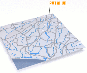 Places with similar names to Putahun, Sierra Leone ::
Disclaimer :: Information on this page comes without warranty of any kind |
||
|
Where is Putahun? Elevation and coordinates ::
Latitude (lat): 7°58'1"N Longitude (lon): 11°4'24"W
Elevation (approx.): 178m (map arrows pan, magnifying glasses zoom) |
||
|
Visiting Putahun? Hotel/Accommodation ::
Book a hotel in Putahun Travel Guide ::
rental cars ::
car rental offers GPS waypoint ::
download a GPX waypoint (PoI) of Putahun for your GPS receiver
|
||