|
search place name
|
||
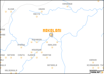
Makalani (Malawi)Makalani is a town in Malawi. An overview map of the region around Makalani is displayed below.
regional and 3d topo map of Makalani, Malawi ::
Makalani airports ::
The nearest airport is LLW - Lilongwe Kamuzu Intl, located 24.5 km north west of Makalani.
Other airports nearby include VXC - Lichinga (157.6 km north east), BLZ - Blantyre Chileka Intl (223.1 km south east), Nearby towns ::
Padzha (1.9km north) //
Mcenza (2.6km south east) //
Mchenga (2.6km south west) //
Kubonda (3.7km south) //
Namlera (3.7km south) //
Mzembera (5.7km west) //
Karzizila (6.6km south west) //
Mlanda (6.6km south west) //
Msonthe (7.6km south) //
Chibwinja (7.4km west) //
Choloamakande (7.4km west) //
Chamonsi (7.7km south west) //
Mndondwe (7.7km south west) //
Kagumbi (9.2km south west) //
Chingila (9.1km south west) //
Nacite (9.2km north west) //
Chimutu (9.2km north west) //
Njobvu (10.3km south west) //
[all distances 'as the bird flies' and approximate]  Places with similar names to Makalani, Malawi ::
Disclaimer :: Information on this page comes without warranty of any kind |
||
|
Where is Makalani? Elevation and coordinates ::
Latitude (lat): 13°55'0"S Longitude (lon): 33°58'0"E
Elevation (approx.): 952m (map arrows pan, magnifying glasses zoom) |
||
|
Visiting Makalani? Hotel/Accommodation ::
Book a hotel in Makalani Travel Guide ::
Buy a travel guide for Malawi rental cars ::
car rental offers GPS waypoint ::
download a GPX waypoint (PoI) of Makalani for your GPS receiver
|
||