|
search place name
|
||
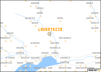
Lavertezzo (Aargau, Switzerland)Lavertezzo is a town in the Aargau region of Switzerland. An overview map of the region around Lavertezzo is displayed below.
regional and 3d topo map of Lavertezzo, Switzerland ::
Lavertezzo airports ::
The nearest airport is LUG - Lugano, located 28.0 km south of Lavertezzo.
Other airports nearby include MXP - Milano Malpensa (69.3 km south), SMV - Samedan (86.8 km east), BGY - Bergamo Orio Al Serio (93.0 km south east), LIN - Milan Linate (95.9 km south), Nearby towns ::
Aquino (1.9km north) //
Corippo (1.9km south) //
Berzona (3.9km south) //
Mergoscia (5.7km south) //
Monti di Odro (4.3km south east) //
Brione (5.3km north west) //
Sceresio (5.3km south west) //
Forna (6.1km north east) //
Contra (7.4km south) //
Minusio (7.5km south) //
Gordola (7.5km south) //
Tenero (7.5km south) //
Gerra (7.8km north) //
Bolastro (7.6km north west) //
[all distances 'as the bird flies' and approximate] 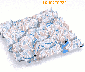 Places with similar names to Lavertezzo, Switzerland ::
// Leveretts (US)
// Lavradas (PT)
// Lavradas (PT)
// La Frutosa (CO)
// La Verdosa (VE)
// La Verdosa (VE)
// La Fraudais (FR)
// La Fretisse (FR)
// La Verdes (FR)
// Le Verdois (FR)
Disclaimer :: Information on this page comes without warranty of any kind |
||
|
Where is Lavertezzo? Elevation and coordinates ::
Latitude (lat): 46°15'0"N Longitude (lon): 8°50'0"E
Elevation (approx.): 1117m (map arrows pan, magnifying glasses zoom) |
||
|
Visiting Lavertezzo? Hotel/Accommodation ::
Book a hotel in Lavertezzo Travel Guide ::
Buy a travel guide for Switzerland rental cars ::
car rental offers GPS waypoint ::
download a GPX waypoint (PoI) of Lavertezzo for your GPS receiver
|
||