|
search place name
|
||
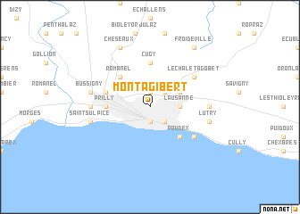
Montagibert (Aargau, Switzerland)Montagibert is a town in the Aargau region of Switzerland. An overview map of the region around Montagibert is displayed below.
regional and 3d topo map of Montagibert, Switzerland ::
nearby GPS traces from timatio ::
Montagibert airports ::
The nearest airport is QNJ - Annemasse, located 47.2 km south west of Montagibert.
Other airports nearby include GVA - Geneva Cointrin (52.0 km south west), SIR - Sion (63.7 km south east), BRN - Bern Belp (78.4 km north east), NCY - Annecy Meythet (78.8 km south west), Nearby towns ::
Ouchy (1.9km south) //
Le Mont-sur-Lausanne (1.9km north) //
Pully (2.2km south east) //
Vennes (2.2km north east) //
Lausanne (2.5km east) //
Epalinges (3.2km north east) //
Romanel (4.5km north west) //
Paudex (4.5km south east) //
Cugy (5.6km north) //
Renens (3.8km west) //
Prilly (3.8km west) //
Crissier (4.2km north west) //
Le Châtelard (5.3km south east) //
Le Chalet-à-Gobet (5.3km north east) //
Chavannes (5.1km west) //
Belmont-sur-Lausanne (5.1km east) //
Saint-Sulpice (5.4km west) //
Bussigny (5.4km west) //
Lutry (5.4km east) //
Cheseaux (7.8km north) //
Froideville (8.3km north east) //
[all distances 'as the bird flies' and approximate] 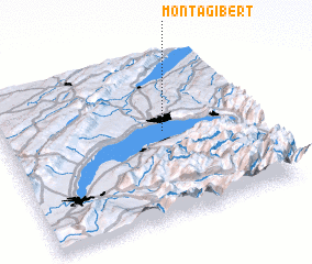 Places with similar names to Montagibert, Switzerland ::
// Monte Giberto (IT)
Disclaimer :: Information on this page comes without warranty of any kind |
||
|
Where is Montagibert? Elevation and coordinates ::
Latitude (lat): 46°32'0"N Longitude (lon): 6°38'0"E
Elevation (approx.): 594m (map arrows pan, magnifying glasses zoom) |
||
|
Visiting Montagibert? Hotel/Accommodation ::
Book a hotel in Montagibert Travel Guide ::
Buy a travel guide for Switzerland rental cars ::
car rental offers GPS waypoint ::
download a GPX waypoint (PoI) of Montagibert for your GPS receiver
|
||