|
search place name
|
||
Sundlauenen (Aargau, Switzerland)Sundlauenen is a town in the Aargau region of Switzerland. An overview map of the region around Sundlauenen is displayed below.
regional and 3d topo map of Sundlauenen, Switzerland ::

Sundlauenen airports ::
The nearest airport is BRN - Bern Belp, located 33.7 km north west of Sundlauenen.
Other airports nearby include SIR - Sion (62.4 km south west), MLH - Bale Mulhouse (102.6 km north), ZRH - Zurich (104.5 km north east), LUG - Lugano (115.0 km south east), Nearby towns ::
Beatenberg (1.9km north) //
Därligen (2.2km south east) //
Mauren (2.2km north east) //
Neuhaus (2.5km east) //
Leissigen (3.9km south) //
Merligen (4.2km north west) //
Krattigen (5.3km south west) //
Wiler (5.3km north west) //
Unterseen (5.1km east) //
Interlaken (5.1km east) //
Faulensee (5.4km west) //
Wilderswil (5.4km east) //
Alpiglen (6.7km north east) //
Saxeten (6.7km south east) //
Bort (6.3km north east) //
Habkern (6.3km north east) //
Schwanden (7.5km north west) //
[all distances 'as the bird flies' and approximate] 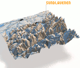 Places with similar names to Sundlauenen, Switzerland :: Disclaimer :: Information on this page comes without warranty of any kind |
||
|
Where is Sundlauenen? Elevation and coordinates ::
Latitude (lat): 46°41'0"N Longitude (lon): 7°47'0"E
Elevation (approx.): 558m (map arrows pan, magnifying glasses zoom) |
||
|
Visiting Sundlauenen? Hotel/Accommodation ::
Book a hotel in Sundlauenen Travel Guide ::
Buy a travel guide for Switzerland rental cars ::
car rental offers GPS waypoint ::
download a GPX waypoint (PoI) of Sundlauenen for your GPS receiver
|
||