|
search place name
|
||
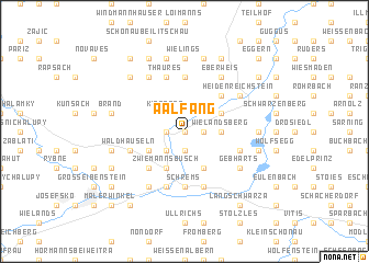
Aalfang (Niederösterreich, Austria)Aalfang is a town in the Niederösterreich region of Austria. An overview map of the region around Aalfang is displayed below.
regional and 3d topo map of Aalfang, Austria ::
Aalfang airports ::
The nearest airport is LNZ - Linz (Horsching), located 93.1 km south west of Aalfang.
Other airports nearby include BRQ - Turany (124.3 km east), VIE - Vienna Schwechat (137.2 km south east), PED - Pardubice (140.0 km north), PRG - Prague Ruzyne (152.6 km north), Nearby towns ::
Unteraalfang (0.0km north) //
Falkendorf (1.2km east) //
Amaliendorf (1.2km east) //
Oberaalfang (1.2km east) //
Winkel (1.9km south) //
Neulangegg (1.2km west) //
Eugenia (2.2km south west) //
Kiensass (2.2km north west) //
Wielandsberg (2.4km east) //
Behofen (3.9km south) //
Kleinpertholz (3.1km north east) //
Kollersdorf (3.9km south) //
Zwiemannsbusch (3.9km south) //
Langegg (3.1km south west) //
Kottinghörmanns (4.4km south west) //
Altmanns (4.4km north east) //
Neuthaures (5.6km north) //
Schrems (5.6km south) //
Ehrenhöbarten (5.7km south) //
Haslau (4.1km south east) //
Waldhäuseln (4.1km south west) //
Niederschrems (5.7km south) //
Thaures (5.7km north) //
Kleedorf (5.7km south) //
Eberweis (6.1km north east) //
Gebharts (5.2km south east) //
Neuniederschrems (6.1km south west) //
Gopprechtshäuser (6.1km north west) //
Bräuhäusl (6.1km south west) //
[all distances 'as the bird flies' and approximate] 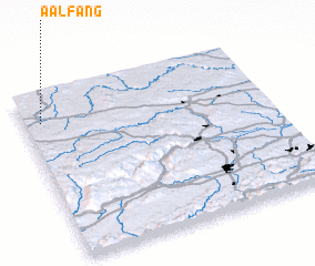 Places with similar names to Aalfang, Austria ::
Disclaimer :: Information on this page comes without warranty of any kind |
||
|
Where is Aalfang? Elevation and coordinates ::
Latitude (lat): 48°50'0"N Longitude (lon): 15°4'0"E
Elevation (approx.): 560m (map arrows pan, magnifying glasses zoom) |
||
|
Visiting Aalfang? Hotel/Accommodation ::
Book a hotel in Aalfang Travel Guide ::
Buy a travel guide for Austria rental cars ::
car rental offers GPS waypoint ::
download a GPX waypoint (PoI) of Aalfang for your GPS receiver
|
||