|
search place name
|
||
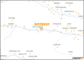
Birnbaum (Kärnten, Austria)Birnbaum is a town in the Kärnten region of Austria. An overview map of the region around Birnbaum is displayed below.
regional and 3d topo map of Birnbaum, Austria ::
Birnbaum airports ::
The nearest airport is AVB - Aviano Ab (Pagliano E Gori), located 76.0 km south of Birnbaum.
Other airports nearby include TRS - Ronchi De Legionari Ronchi Dei Legionari (105.4 km south east), KLU - Klagenfurt (Worthersee Intl) (111.0 km east), BZO - Bolzano (122.3 km west), SZG - Salzburg (123.6 km north), Nearby towns ::
Wodmaier (0.4km west) //
Kornat (0.7km north east) //
Nostra (1.5km south west) //
Mattling (1.6km west) //
Aigen (2.6km east) //
Sittmoos (3.4km east) //
Niedergail (3.8km west) //
Sankt Jakob im Lesachtal (3.8km east) //
Strajach (5.0km east) //
Liesing (5.4km west) //
Untertscheltsch (5.7km west) //
Gentschach (5.9km east) //
Unterpirkach (8.5km north) //
Flaschberg (8.2km north east) //
Gailberg (7.8km north east) //
Plöcken (8.9km south east) //
Oetting (8.0km north east) //
Rosenberg (10.1km north east) //
[all distances 'as the bird flies' and approximate]  Places with similar names to Birnbaum, Austria ::
Disclaimer :: Information on this page comes without warranty of any kind |
||
|
Where is Birnbaum? Elevation and coordinates ::
Latitude (lat): 46°41'5"N Longitude (lon): 12°53'19"E
Elevation (approx.): 949m (map arrows pan, magnifying glasses zoom) |
||
|
Visiting Birnbaum? Hotel/Accommodation ::
Book a hotel in Birnbaum Travel Guide ::
Buy a travel guide for Austria rental cars ::
car rental offers GPS waypoint ::
download a GPX waypoint (PoI) of Birnbaum for your GPS receiver
|
||