|
search place name
|
||
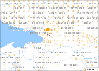
Ebnet (Vorarlberg, Austria)Ebnet is a town in the Vorarlberg region of Austria. An overview map of the region around Ebnet is displayed below.
regional and 3d topo map of Ebnet, Austria ::
Ebnet airports ::
The nearest airport is ACH - St Gallen Altenrhein, located 16.7 km west of Ebnet.
Other airports nearby include FDH - Friedrichshafen (24.8 km north west), ZRH - Zurich (92.4 km west), ZQL - Donaueschingen Villingen (105.6 km north west), SMV - Samedan (111.4 km south), Nearby towns ::
Fallenberg (0.3km south east) //
Eglisberg (0.6km west) //
Juggen (0.8km south east) //
Halden (0.8km west) //
Ruggburg (1.1km north) //
Eplisgehr (0.9km east) //
Eichenberg (0.9km east) //
Hausreute (1.3km south west) //
Unterhaggen (1.7km south west) //
Buchenberg (1.8km south) //
Flühlen (1.8km south) //
Hof (1.8km south) //
Grünegger (1.8km south) //
Backenreute (1.9km north) //
Am Vögel (1.9km south) //
Stegen (2.0km north) //
Lohorn (2.2km south) //
Giggelstein (2.0km north) //
Am Stein (1.6km south west) //
Hub (2.0km south east) //
Fronhofen (1.6km west) //
Hofen (1.6km west) //
Lochau (1.6km west) //
Brantmann (2.0km north west) //
Lutzenreute (2.1km north east) //
Alberloch (1.7km west) //
Moos (2.2km south east) //
Riese (2.5km south) //
Klausberg (2.1km south west) //
[all distances 'as the bird flies' and approximate]  Places with similar names to Ebnet, Austria ::
Disclaimer :: Information on this page comes without warranty of any kind |
||
|
Where is Ebnet? Elevation and coordinates ::
Latitude (lat): 47°31'59"N Longitude (lon): 9°46'15"E
Elevation (approx.): 692m (map arrows pan, magnifying glasses zoom) |
||
|
Visiting Ebnet? Hotel/Accommodation ::
Book a hotel in Ebnet Travel Guide ::
Buy a travel guide for Austria rental cars ::
car rental offers GPS waypoint ::
download a GPX waypoint (PoI) of Ebnet for your GPS receiver
|
||