|
search place name
|
||
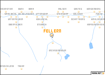
Fellern (Salzburg, Austria)Fellern is a town in the Salzburg region of Austria. An overview map of the region around Fellern is displayed below.
regional and 3d topo map of Fellern, Austria ::
nearby GPS traces from timatio ::
Fellern airports ::
The nearest airport is SZG - Salzburg, located 71.0 km north east of Fellern.
Other airports nearby include INN - Innsbruck (95.2 km west), BZO - Bolzano (128.5 km south west), AVB - Aviano Ab (Pagliano E Gori) (131.7 km south), OBF - Oberpfaffenhofen (138.0 km north west), Nearby towns ::
Schneiderau (1.9km south) //
Stubach (4.5km north west) //
Enzingerboden (5.7km south) //
Köhlbichl (6.1km north west) //
Tobersbach (7.5km north) //
Lengdorf (7.5km north) //
Hauptmannsdorf (7.5km north) //
Uggl (7.5km north) //
Mühlbach (6.7km north east) //
Uttendorf (7.8km north) //
Aisdorf (7.8km north) //
Steindorf (7.8km north) //
Pirtendorf (8.3km north west) //
Litzldorf (8.3km north west) //
Niedernsill (8.3km north east) //
[all distances 'as the bird flies' and approximate] 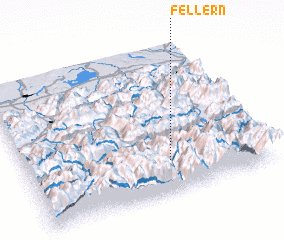 Places with similar names to Fellern, Austria ::
// Villa Arrién (BO)
// Vollern (AT)
// Florin (US)
// Flourney (US)
// Flournoy (US)
// Valley Run (US)
// Floren (DE)
// Fluorn (DE)
// Flüren (DE)
// Vellern (DE)
Disclaimer :: Information on this page comes without warranty of any kind |
||
|
Where is Fellern? Elevation and coordinates ::
Latitude (lat): 47°13'0"N Longitude (lon): 12°36'0"E
Elevation (approx.): 1199m (map arrows pan, magnifying glasses zoom) |
||
|
Visiting Fellern? Hotel/Accommodation ::
Book a hotel in Fellern Travel Guide ::
Buy a travel guide for Austria rental cars ::
car rental offers GPS waypoint ::
download a GPX waypoint (PoI) of Fellern for your GPS receiver
|
||