|
search place name
|
||
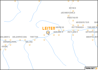
Leiten (Salzburg, Austria)Leiten is a town in the Salzburg region of Austria. An overview map of the region around Leiten is displayed below.
regional and 3d topo map of Leiten, Austria ::
nearby GPS traces from timatio ::
Leiten airports ::
The nearest airport is INN - Innsbruck, located 74.9 km west of Leiten.
Other airports nearby include SZG - Salzburg (77.3 km north east), BZO - Bolzano (118.0 km south west), OBF - Oberpfaffenhofen (120.1 km north west), MUC - Munich Munchen (127.6 km north), Nearby towns ::
Hohenbramberg (1.3km west) //
Weyer (1.3km west) //
Bramberg am Wildkogel (1.3km east) //
Wenns (1.3km east) //
Habach (2.2km south west) //
Schönbach (2.2km south west) //
Mühlbach (2.5km east) //
Bicheln (3.1km north east) //
Mühlberg (3.1km north east) //
Obermühlbach (3.1km north east) //
Schweinegg (3.1km north east) //
Dorf (4.2km north east) //
Tratten (4.2km south west) //
Neukirchen am Großvenediger (4.2km south west) //
Sulzau (6.2km south west) //
Jochbergwald (9.0km north east) //
[all distances 'as the bird flies' and approximate]  Places with similar names to Leiten, Austria ::
Disclaimer :: Information on this page comes without warranty of any kind |
||
|
Where is Leiten? Elevation and coordinates ::
Latitude (lat): 47°16'0"N Longitude (lon): 12°20'0"E
Elevation (approx.): 819m (map arrows pan, magnifying glasses zoom) |
||
|
Visiting Leiten? Hotel/Accommodation ::
Book a hotel in Leiten Travel Guide ::
Buy a travel guide for Austria rental cars ::
car rental offers GPS waypoint ::
download a GPX waypoint (PoI) of Leiten for your GPS receiver
|
||