|
search place name
|
||
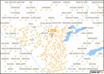
Lina (Salzburg, Austria)Lina is a town in the Salzburg region of Austria. An overview map of the region around Lina is displayed below.
regional and 3d topo map of Lina, Austria ::
Lina airports ::
The nearest airport is SZG - Salzburg, located 18.9 km south of Lina.
Other airports nearby include LNZ - Linz (Horsching) (90.9 km east), MUC - Munich Munchen (102.6 km north west), OBF - Oberpfaffenhofen (131.4 km west), FEL - Fuerstenfeldbruck Furstenfeldbruck (134.5 km west), Nearby towns ::
Ammeroid (0.5km south) //
Spatzenegg (0.4km north west) //
Hub (0.6km east) //
Geiersberg (1.2km north) //
Aigen (1.1km north east) //
Absmann (1.4km south) //
Großenegg (1.3km north) //
Ansfelden (1.1km east) //
Schupfen (1.2km south east) //
Holzmannberg (1.1km west) //
Schwandt (1.6km north) //
Kleinegg (1.6km north) //
Webersdorf (1.7km south) //
Kletzlberg (1.2km west) //
Innerwall (1.6km south east) //
Sprungedt (1.5km north east) //
Hörndl (1.8km south west) //
Mangerberg (2.1km north) //
Haßberg (1.5km south west) //
Neuhäusl (2.1km south) //
Steinbach (1.5km west) //
Kleinberg (1.6km south west) //
Schwandtl (2.3km north) //
Gaisberg (2.1km south west) //
Doppl (2.3km south) //
Moos (1.6km east) //
Grub (2.2km north east) //
Außerwall (2.2km south) //
Strauchmühle (2.2km north east) //
[all distances 'as the bird flies' and approximate]  Places with similar names to Lina, Austria ::
Disclaimer :: Information on this page comes without warranty of any kind |
||
|
Where is Lina? Elevation and coordinates ::
Latitude (lat): 47°57'44"N Longitude (lon): 13°2'8"E
Elevation (approx.): 650m (map arrows pan, magnifying glasses zoom) |
||
|
Visiting Lina? Hotel/Accommodation ::
Book a hotel in Lina Travel Guide ::
Buy a travel guide for Austria rental cars ::
car rental offers GPS waypoint ::
download a GPX waypoint (PoI) of Lina for your GPS receiver
|
||