|
search place name
|
||
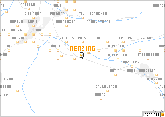
Nenzing (Vorarlberg, Austria)Nenzing is a town in the Vorarlberg region of Austria. An overview map of the region around Nenzing is displayed below.
regional and 3d topo map of Nenzing, Austria ::
Nenzing airports ::
The nearest airport is ACH - St Gallen Altenrhein, located 35.2 km north of Nenzing.
Other airports nearby include FDH - Friedrichshafen (56.1 km north), SMV - Samedan (73.5 km south), ZRH - Zurich (92.5 km west), ZQL - Donaueschingen Villingen (124.8 km north west), Nearby towns ::
Beschling (1.3km west) //
Schlins (1.9km north) //
Gais (1.7km north east) //
Frommengärsch (2.3km north west) //
Röns (3.7km north) //
Bludesch (3.1km north east) //
Düns (3.9km north) //
Gampelün (3.3km west) //
Schnifis (4.5km north east) //
Satteins (4.5km north west) //
Latz (3.8km west) //
Mittelberg (4.2km north west) //
Motten (4.2km north west) //
Bassing (5.3km north east) //
Thüringen (5.4km east) //
Gurtis (5.4km west) //
Unterfeld (5.4km east) //
Matin (6.3km south east) //
Innerlaterns (7.9km north) //
Übersaxen (7.9km north) //
Gallaverda (8.3km south east) //
Pfitz (8.3km north west) //
Tufers (8.3km north west) //
Göfis (7.5km north west) //
Dums (7.5km north west) //
[all distances 'as the bird flies' and approximate]  Places with similar names to Nenzing, Austria ::
// Nansang (MM)
// Nanzing (DE)
// Non Sang (TH)
// Non Sung (TH)
// Nanissonga (BF)
// Nanissonga (BF)
// Nansanga (UG)
// Nansenga (ZM)
// Nan-hsing (TW)
// Nan-hsiung (TW)
Disclaimer :: Information on this page comes without warranty of any kind |
||
|
Where is Nenzing? Elevation and coordinates ::
Latitude (lat): 47°10'59"N Longitude (lon): 9°42'0"E
Elevation (approx.): 544m (map arrows pan, magnifying glasses zoom) |
||
|
Visiting Nenzing? Hotel/Accommodation ::
Book a hotel in Nenzing Travel Guide ::
Buy a travel guide for Austria rental cars ::
car rental offers GPS waypoint ::
download a GPX waypoint (PoI) of Nenzing for your GPS receiver
|
||