|
search place name
|
||
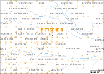
Rittschein (Steiermark, Austria)Rittschein is a town in the Steiermark region of Austria. An overview map of the region around Rittschein is displayed below.
regional and 3d topo map of Rittschein, Austria ::
Rittschein airports ::
The nearest airport is GRZ - Graz, located 46.4 km west of Rittschein.
Other airports nearby include MBX - Maribor (64.2 km south west), VIE - Vienna Schwechat (129.5 km north), KLU - Klagenfurt (Worthersee Intl) (136.6 km west), ZAG - Zagreb (139.7 km south), Nearby towns ::
Rohrbach (0.0km north) //
Kleinkögeln (0.0km north) //
Oberlamm (1.2km south) //
Scheibelbuch (1.3km east) //
Grundberg (1.9km south) //
Übersbach (1.9km north) //
Frauenberg (1.3km west) //
Bärnbach (1.9km south) //
Hartl bei Fürstenfeld (1.9km north) //
Grank (2.2km south east) //
Edelsbach (2.2km south east) //
Vorderberg (2.2km south east) //
Wiesenberg (2.2km south west) //
Setzberg (2.2km south west) //
Spedl (2.2km south west) //
Unterlamm (2.8km south) //
Habegg (2.6km south west) //
Stieglitz (2.5km east) //
Welsdorf (3.7km north) //
Ederberg (2.5km west) //
Oedgraben (2.5km west) //
Zoppolten (3.7km south) //
Edlich (3.7km south) //
Dörfla (3.7km south) //
Fröhlichberg (3.7km south) //
Birnbach (3.7km south) //
Stein (2.8km east) //
Hiebüchl (3.1km south east) //
Rohrbach (3.9km south) //
[all distances 'as the bird flies' and approximate]  Places with similar names to Rittschein, Austria ::
Disclaimer :: Information on this page comes without warranty of any kind |
||
|
Where is Rittschein? Elevation and coordinates ::
Latitude (lat): 47°0'0"N Longitude (lon): 16°3'0"E
Elevation (approx.): 361m (map arrows pan, magnifying glasses zoom) |
||
|
Visiting Rittschein? Hotel/Accommodation ::
Book a hotel in Rittschein Travel Guide ::
Buy a travel guide for Austria rental cars ::
car rental offers GPS waypoint ::
download a GPX waypoint (PoI) of Rittschein for your GPS receiver
|
||