|
search place name
|
||
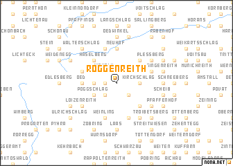
Roggenreith (Niederösterreich, Austria)Roggenreith is a town in the Niederösterreich region of Austria. An overview map of the region around Roggenreith is displayed below.
regional and 3d topo map of Roggenreith, Austria ::
Roggenreith airports ::
The nearest airport is LNZ - Linz (Horsching), located 75.7 km west of Roggenreith.
Other airports nearby include VIE - Vienna Schwechat (107.3 km east), BRQ - Turany (140.1 km north east), GRZ - Graz (156.0 km south), PED - Pardubice (185.7 km north), Nearby towns ::
Kleinpertholz (1.2km west) //
Pitzeichen (1.2km west) //
Walpersdorf (2.2km south west) //
Muckendorf (2.2km south east) //
Wiehalm (2.2km north west) //
Mitterndorf (2.5km west) //
Kirchschlag (2.5km east) //
Martinsberg (3.1km south west) //
Poggschlag (3.1km south west) //
Kleingerungs (3.1km north west) //
Weixelberg (3.1km north west) //
Braunegg (4.5km south east) //
Haselberg (4.4km north west) //
Ottenschlag (4.4km north east) //
Jungschlag (4.4km north east) //
Oed (3.7km west) //
Neuhof (5.6km north) //
Weinling (5.7km south) //
Biberschlag (5.7km north) //
Aschelberg (5.7km south) //
Bergern (5.7km south) //
Reitzendorf (4.1km north west) //
Bernhardshof (4.1km north east) //
Eck (4.1km north east) //
Loizenreith (5.2km south west) //
Klebing (5.2km south east) //
Loibersdorf (6.1km south east) //
Plessberg (5.2km north east) //
Laas (7.4km south) //
[all distances 'as the bird flies' and approximate]  Places with similar names to Roggenreith, Austria ::
// Reckenroth (DE)
Disclaimer :: Information on this page comes without warranty of any kind |
||
|
Where is Roggenreith? Elevation and coordinates ::
Latitude (lat): 48°23'0"N Longitude (lon): 15°11'0"E
Elevation (approx.): 853m (map arrows pan, magnifying glasses zoom) |
||
|
Visiting Roggenreith? Hotel/Accommodation ::
Book a hotel in Roggenreith Travel Guide ::
Buy a travel guide for Austria rental cars ::
car rental offers GPS waypoint ::
download a GPX waypoint (PoI) of Roggenreith for your GPS receiver
|
||