|
search place name
|
||
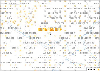
Rumersdorf (Oberösterreich, Austria)Rumersdorf is a town in the Oberösterreich region of Austria. An overview map of the region around Rumersdorf is displayed below.
regional and 3d topo map of Rumersdorf, Austria ::
nearby GPS traces from timatio ::
Rumersdorf airports ::
The nearest airport is LNZ - Linz (Horsching), located 35.2 km south east of Rumersdorf.
Other airports nearby include SZG - Salzburg (98.6 km south west), PRG - Prague Ruzyne (184.0 km north), GRZ - Graz (202.1 km south east), KLV - Karlovy Vary (205.1 km north), Nearby towns ::
Niederkappel (1.2km east) //
Innzel (1.9km south) //
Niederbumberg (1.9km south) //
Oberbumberg (1.2km west) //
Römersdorf (2.2km north east) //
Witzersdorf (2.2km north east) //
Lembach im Mühlkreis (2.2km north east) //
Grafenau (2.2km south east) //
Weikersdorf (2.2km south east) //
Steinstrass (2.2km north west) //
Harrau (2.2km north west) //
Amersdorf (2.5km east) //
Eckersdorf (3.7km south) //
Ritzersdorf (3.1km north east) //
Raiden (3.1km north east) //
Obergschwendt (3.1km south east) //
Mairing (3.9km north) //
Haag (3.9km north) //
Linetshub (3.9km south) //
Mannsdorf (3.9km south) //
Dorf (3.1km south west) //
Feichten (4.4km north east) //
Untergschwendt (4.4km south east) //
Pfarrkirchen im Mühlkreise (4.4km north west) //
Schlögen (5.6km south) //
Marsbach (3.7km west) //
Emmerstorf (3.7km west) //
Gemersdorf (5.7km south) //
Volkersdorf (4.1km north east) //
[all distances 'as the bird flies' and approximate]  Places with similar names to Rumersdorf, Austria ::
// Ramersdorf (AT)
// Rammersdorf (AT)
// Rammersdorf (AT)
// Rammerstorf (AT)
// Römersdorf (AT)
// Rumerstorf (AT)
// Ramersdorf (DE)
// Ramersdorf (DE)
// Ramersdorf (DE)
// Ramersdorf (DE)
Disclaimer :: Information on this page comes without warranty of any kind |
||
|
Where is Rumersdorf? Elevation and coordinates ::
Latitude (lat): 48°28'0"N Longitude (lon): 13°52'0"E
Elevation (approx.): 546m (map arrows pan, magnifying glasses zoom) |
||
|
Visiting Rumersdorf? Hotel/Accommodation ::
Book a hotel in Rumersdorf Travel Guide ::
Buy a travel guide for Austria rental cars ::
car rental offers GPS waypoint ::
download a GPX waypoint (PoI) of Rumersdorf for your GPS receiver
|
||