|
search place name
|
||
Sankt Stefan (Kärnten, Austria)Sankt Stefan is a town in the Kärnten region of Austria. An overview map of the region around Sankt Stefan is displayed below.
regional and 3d topo map of Sankt Stefan, Austria ::

nearby GPS traces from timatio ::
Sankt Stefan airports ::
The nearest airport is KLU - Klagenfurt (Worthersee Intl), located 43.4 km south west of Sankt Stefan.
Other airports nearby include GRZ - Graz (49.2 km north east), LJU - Ljubliana Ljubljana (71.6 km south west), MBX - Maribor (73.5 km south east), ZAG - Zagreb (151.0 km south east), Nearby towns ::
Maildorf (0.8km south) //
Großedling (0.8km south) //
Reding (1.0km north) //
Paildorf (1.5km north east) //
Sankt Johann (1.5km north east) //
Völking (1.7km west) //
Wolkersdorf (2.7km south) //
Kleinedling (2.0km west) //
Kleinwinklern (2.9km north) //
Sankt Marein (2.3km west) //
Sankt Jakob (3.2km north west) //
Reideben (2.6km east) //
Michaelsdorf (2.6km east) //
Wolfsberg (3.7km north) //
Riegelsdorf (2.9km south east) //
Fischering (3.1km south west) //
Reinfelsdorf (2.9km west) //
Sankt Thomas (2.9km west) //
Vordergumitsch (3.7km north east) //
Magersdorf (4.5km south) //
Siebending (4.5km south) //
Oberaigen (3.4km south west) //
Fischering (3.8km south west) //
Kleinrojach (3.8km south west) //
Mosern (4.7km south) //
Altendorf (3.9km north west) //
Wölzing (4.3km south west) //
Hintergumitsch (4.9km north) //
Frantschach (4.9km north) //
[all distances 'as the bird flies' and approximate] 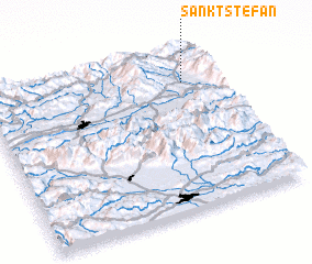 Places with similar names to Sankt Stefan, Austria ::
// Sankt Stephan (CH)
// Sankt Stefan (AT)
// Sankt Stefan (AT)
// Sankt Stefan (AT)
// Sankt Stefan (AT)
// Sankt Stefan (AT)
// Sankt Stefan (AT)
// Sankt Stephan (DE)
// Sankt Stephan (DE)
// Sankt Stefan (AT)
Disclaimer :: Information on this page comes without warranty of any kind |
||
|
Where is Sankt Stefan? Elevation and coordinates ::
Latitude (lat): 46°48'27"N Longitude (lon): 14°51'6"E
Elevation (approx.): 438m (map arrows pan, magnifying glasses zoom) |
||
|
Visiting Sankt Stefan? Hotel/Accommodation ::
Book a hotel in Sankt Stefan Travel Guide ::
Buy a travel guide for Austria rental cars ::
car rental offers GPS waypoint ::
download a GPX waypoint (PoI) of Sankt Stefan for your GPS receiver
|
||