|
search place name
|
||
Sättels (Vorarlberg, Austria)Sättels is a town in the Vorarlberg region of Austria. An overview map of the region around Sättels is displayed below.
regional and 3d topo map of Sättels, Austria ::

Sättels airports ::
The nearest airport is ACH - St Gallen Altenrhein, located 20.2 km south west of Sättels.
Other airports nearby include FDH - Friedrichshafen (24.7 km north west), ZRH - Zurich (95.0 km west), ZQL - Donaueschingen Villingen (106.0 km north west), SMV - Samedan (114.9 km south), Nearby towns ::
Ramsach (0.1km north west) //
Rucksteig (0.1km north west) //
Essenreute (0.7km north west) //
Ried (1.0km south) //
Kapf (1.2km north) //
Höflings (1.2km south west) //
Großen (1.4km south west) //
Weienried (1.2km east) //
Möggers (1.2km east) //
Geigers (1.8km south) //
Sellengehr (1.9km north) //
Schönstein (1.9km north) //
Lerschen (1.9km north) //
Göhren (1.9km north) //
Finken (1.3km west) //
Andreute (1.3km west) //
Schüssellehen (2.4km south) //
Schatten (1.8km north west) //
Buchans (2.2km north east) //
Lutzenreute (2.2km south west) //
Glend (2.3km north west) //
Hub (2.3km north west) //
Hohenweiler (2.3km north west) //
Stegen (2.6km south west) //
Feßlers (2.3km west) //
Gschwend (3.3km south) //
Ebenschwand (2.4km east) //
Haslach (2.8km north west) //
Hinteregg (3.7km south) //
[all distances 'as the bird flies' and approximate] 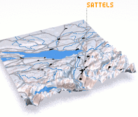 Places with similar names to Sättels, Austria ::
Disclaimer :: Information on this page comes without warranty of any kind |
||
|
Where is Sättels? Elevation and coordinates ::
Latitude (lat): 47°33'59"N Longitude (lon): 9°48'3"E
Elevation (approx.): 889m (map arrows pan, magnifying glasses zoom) |
||
|
Visiting Sättels? Hotel/Accommodation ::
Book a hotel in Sättels Travel Guide ::
Buy a travel guide for Austria rental cars ::
car rental offers GPS waypoint ::
download a GPX waypoint (PoI) of Sättels for your GPS receiver
|
||