|
search place name
|
||
Schweinach (Tirol, Austria)Schweinach is a town in the Tirol region of Austria. An overview map of the region around Schweinach is displayed below.
regional and 3d topo map of Schweinach, Austria ::

Schweinach airports ::
The nearest airport is SZG - Salzburg, located 95.9 km north of Schweinach.
Other airports nearby include INN - Innsbruck (97.8 km west), AVB - Aviano Ab (Pagliano E Gori) (105.8 km south), BZO - Bolzano (111.2 km south west), KLU - Klagenfurt (Worthersee Intl) (140.4 km east), Nearby towns ::
Seblas (1.2km north west) //
Mattersberg (1.9km south) //
Feld (2.4km south) //
Klausen (2.2km south west) //
Klaunz (2.2km north west) //
Hinterburg (2.2km north west) //
Moos (3.7km south) //
Matrei in Osttirol (3.1km north west) //
Kaltenhaus (3.9km north) //
Glanz (3.9km north) //
Bichl (2.9km west) //
Prossegg (4.5km north west) //
Oberhuben (5.6km south) //
Guggenberg (3.8km west) //
Huben (5.6km south) //
Staniska (4.9km south east) //
Unterpeischlach (5.7km south) //
Peischlach (5.7km south) //
Dölach (5.7km south) //
Sankt Nikolaus (4.2km north west) //
Oberpeischlach (5.5km south east) //
Ratzell (5.9km south) //
Unterhuben (6.4km south) //
Oblass (6.1km south east) //
Hinteregg (5.3km north west) //
Stein (6.1km north west) //
Oberlesach (5.1km east) //
Arnig (5.4km east) //
Nieder Arnig (5.4km east) //
[all distances 'as the bird flies' and approximate] 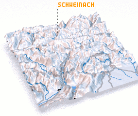 Places with similar names to Schweinach, Austria :: Disclaimer :: Information on this page comes without warranty of any kind |
||
|
Where is Schweinach? Elevation and coordinates ::
Latitude (lat): 46°59'0"N Longitude (lon): 12°34'0"E
Elevation (approx.): 1619m (map arrows pan, magnifying glasses zoom) |
||
|
Visiting Schweinach? Hotel/Accommodation ::
Book a hotel in Schweinach Travel Guide ::
Buy a travel guide for Austria rental cars ::
car rental offers GPS waypoint ::
download a GPX waypoint (PoI) of Schweinach for your GPS receiver
|
||