|
search place name
|
||
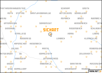
Sichart (Steiermark, Austria)Sichart is a town in the Steiermark region of Austria. An overview map of the region around Sichart is displayed below.
regional and 3d topo map of Sichart, Austria ::
nearby GPS traces from timatio ::
Sichart airports ::
The nearest airport is GRZ - Graz, located 53.7 km south west of Sichart.
Other airports nearby include VIE - Vienna Schwechat (97.1 km north east), MBX - Maribor (102.8 km south), BTS - Bratislava M R Stefanik (135.2 km north east), KLU - Klagenfurt (Worthersee Intl) (140.5 km south west), Nearby towns ::
Lembach (3.1km south east) //
Sommersgut (3.9km north) //
Pittermann (3.1km north west) //
Prätis (5.7km south) //
Miesenbach (5.3km south west) //
Kandlbauer (5.3km north west) //
Vorau (5.0km east) //
Köppelreith (7.5km south) //
Reifbach (6.7km north east) //
Mönichwald (6.7km north east) //
Sankt Jakob im Walde (7.8km north) //
Wetzelberg (8.3km north east) //
Dörfl (8.3km north east) //
[all distances 'as the bird flies' and approximate] 
Disclaimer :: Information on this page comes without warranty of any kind |
||
|
Where is Sichart? Elevation and coordinates ::
Latitude (lat): 47°24'0"N Longitude (lon): 15°49'0"E
Elevation (approx.): 770m (map arrows pan, magnifying glasses zoom) |
||
|
Visiting Sichart? Hotel/Accommodation ::
Book a hotel in Sichart Travel Guide ::
Buy a travel guide for Austria rental cars ::
car rental offers GPS waypoint ::
download a GPX waypoint (PoI) of Sichart for your GPS receiver
|
||