|
search place name
|
||
Stallhofen (Steiermark, Austria)Stallhofen is a town in the Steiermark region of Austria. An overview map of the region around Stallhofen is displayed below.
regional and 3d topo map of Stallhofen, Austria ::

Stallhofen airports ::
The nearest airport is GRZ - Graz, located 18.2 km east of Stallhofen.
Other airports nearby include MBX - Maribor (72.8 km south east), KLU - Klagenfurt (Worthersee Intl) (80.9 km south west), LJU - Ljubliana Ljubljana (108.7 km south west), LNZ - Linz (Horsching) (152.6 km north west), Nearby towns ::
Kalchberg (1.3km east) //
Kleingaisfeld (1.9km south) //
Aichegg (1.3km west) //
Bernau (2.2km south east) //
Gasselberg (2.2km south west) //
Thallein (2.2km south west) //
Rassberg (2.2km north west) //
Krottendorf bei Ligist (3.7km south) //
Sankt Johann ob Hohenburg (3.7km south) //
Muggauberg (3.7km south) //
Michelbach (2.5km east) //
Lobming (2.5km west) //
Grossgaisfeld (3.9km south) //
Hausdorf (3.1km south east) //
Lichtenegg (3.1km north east) //
Sankt Bartholomä (3.1km north east) //
Krems (3.1km south west) //
Neudorf bei Sankt Johann ob Hohenburg (4.5km south east) //
Jaritzberg (4.5km north east) //
Stiwoll (5.6km north) //
Köppling (5.7km south) //
Reiteregg (4.2km south east) //
Lobmingberg (4.2km north west) //
Ligist (6.3km south) //
Arnstein (5.3km south west) //
Berndorf (5.3km south east) //
Pichling bei Mooskirchen (5.3km south east) //
Sankt Oswald bei Plankenwarth (5.3km north east) //
Rohrbach (5.1km east) //
[all distances 'as the bird flies' and approximate] 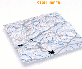 Places with similar names to Stallhofen, Austria ::
// Stallhofen (AT)
// Stallhofen (AT)
// Stallhofen (AT)
// Stollhofen (AT)
// Stahlhofen (DE)
// Stollhofen (DE)
// Sidi el Hafiane (MA)
// Steelhoven (NL)
// Stahlhofen (DE)
Disclaimer :: Information on this page comes without warranty of any kind |
||
|
Where is Stallhofen? Elevation and coordinates ::
Latitude (lat): 47°3'0"N Longitude (lon): 15°13'0"E
Elevation (approx.): 407m (map arrows pan, magnifying glasses zoom) |
||
|
Visiting Stallhofen? Hotel/Accommodation ::
Book a hotel in Stallhofen Travel Guide ::
Buy a travel guide for Austria rental cars ::
car rental offers GPS waypoint ::
download a GPX waypoint (PoI) of Stallhofen for your GPS receiver
|
||