|
search place name
|
||
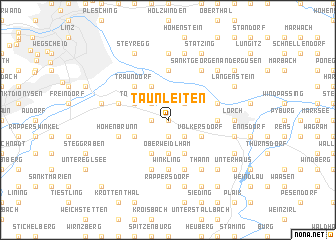
Taunleiten (Oberösterreich, Austria)Taunleiten is a town in the Oberösterreich region of Austria. An overview map of the region around Taunleiten is displayed below.
regional and 3d topo map of Taunleiten, Austria ::
nearby GPS traces from timatio ::
Taunleiten airports ::
The nearest airport is LNZ - Linz (Horsching), located 15.9 km west of Taunleiten.
Other airports nearby include SZG - Salzburg (114.3 km south west), GRZ - Graz (157.1 km south east), KLU - Klagenfurt (Worthersee Intl) (175.1 km south), PRG - Prague Ruzyne (209.8 km north), Nearby towns ::
Asten (0.0km north) //
Unterweidlham (1.9km south) //
Weilling (1.9km south) //
Splitteraichet (1.2km west) //
Raffelstetten (2.2km north west) //
Bruck bei Tödling (2.2km north west) //
Ipfdorf (2.2km north east) //
Fisching (2.2km north east) //
Tillysburg (2.2km south east) //
Samesleiten (2.2km south east) //
Oberweidlham (3.7km south) //
Pichling (3.1km north west) //
Tödling (3.1km north west) //
Volkersdorf (3.1km south east) //
Markt Sankt Florian (3.1km south west) //
Posch (3.9km north) //
Fernbach (3.9km south) //
Hausleiten (3.9km south) //
Traundorf (4.5km north west) //
Winkling (5.6km south) //
Kristein (3.7km east) //
Einsiedl (3.7km east) //
Pulgarn (5.6km north) //
Kronau (4.1km north east) //
Oelkam (4.1km north west) //
Distelberg (5.7km south) //
Franzberg (5.7km south) //
Enzing (4.1km south west) //
Hohenbrunn (4.1km south west) //
[all distances 'as the bird flies' and approximate]  Places with similar names to Taunleiten, Austria ::
// Tenleytown (US)
// Tunnelton (US)
// Dennilton (ZA)
// Danleyton (US)
// Danieltown (US)
// Donnellytown (US)
// Tunnelton (US)
// Danieltown (US)
// Dan Ladan (NG)
// Tunnelton (US)
Disclaimer :: Information on this page comes without warranty of any kind |
||
|
Where is Taunleiten? Elevation and coordinates ::
Latitude (lat): 48°13'0"N Longitude (lon): 14°24'0"E
Elevation (approx.): 252m (map arrows pan, magnifying glasses zoom) |
||
|
Visiting Taunleiten? Hotel/Accommodation ::
Book a hotel in Taunleiten Travel Guide ::
Buy a travel guide for Austria rental cars ::
car rental offers GPS waypoint ::
download a GPX waypoint (PoI) of Taunleiten for your GPS receiver
|
||