|
search place name
|
||
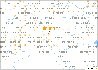
Achen (Bayern, Germany)Achen is a town in the Bayern region of Germany. An overview map of the region around Achen is displayed below.
regional and 3d topo map of Achen, Germany ::
Achen airports ::
The nearest airport is OBF - Oberpfaffenhofen, located 46.3 km north east of Achen.
Other airports nearby include INN - Innsbruck (57.6 km south east), FEL - Fuerstenfeldbruck Furstenfeldbruck (58.4 km north), AGB - Augsburg (78.9 km north), MUC - Munich Munchen (92.7 km north east), Nearby towns ::
Schwaig (0.0km north) //
Schönberg (0.0km north) //
Lettigenbichl (0.0km north) //
Engle (1.2km west) //
Schönegg (1.2km west) //
Mühlegg (1.9km north) //
Ammerthal (1.9km north) //
Echelsbach (1.9km south) //
Gschwendt (1.9km south) //
Rottenbuch (2.2km north west) //
Solder (2.2km north west) //
Ölberg (2.2km north west) //
Murgenbach (2.2km south west) //
Mitterkirnberg (2.2km north east) //
Vorderkirnberg (2.2km north east) //
Böbing (3.7km north) //
Pischlach (3.7km north) //
Wimpes (3.7km north) //
Kreut (3.7km south) //
Moos (3.9km north) //
Holzleithen (3.9km north) //
Wildsteig (3.1km south west) //
Unterkirnberg (3.1km north east) //
Bayersoien (3.9km south) //
Kirmesau (3.1km south east) //
Krummengraben (4.5km north west) //
Morgenbach (4.5km south west) //
Thalmühl (5.6km north) //
Leithen (5.6km north) //
[all distances 'as the bird flies' and approximate]  Places with similar names to Achen, Germany ::
Disclaimer :: Information on this page comes without warranty of any kind |
||
|
Where is Achen? Elevation and coordinates ::
Latitude (lat): 47°43'0"N Longitude (lon): 10°59'0"E
Elevation (approx.): 801m (map arrows pan, magnifying glasses zoom) |
||
|
Visiting Achen? Hotel/Accommodation ::
Book a hotel in Achen Travel Guide ::
Buy a travel guide for Germany rental cars ::
car rental offers GPS waypoint ::
download a GPX waypoint (PoI) of Achen for your GPS receiver
|
||